Mavic 3T Guide: Scouting Vineyards Precisely
Mavic 3T Guide: Scouting Vineyards Precisely
META: Discover how the DJI Mavic 3T transforms vineyard scouting with thermal imaging, photogrammetry, and precision sensors across complex terrain.
By James Mitchell | Drone Systems Expert & Precision Agriculture Specialist
TL;DR
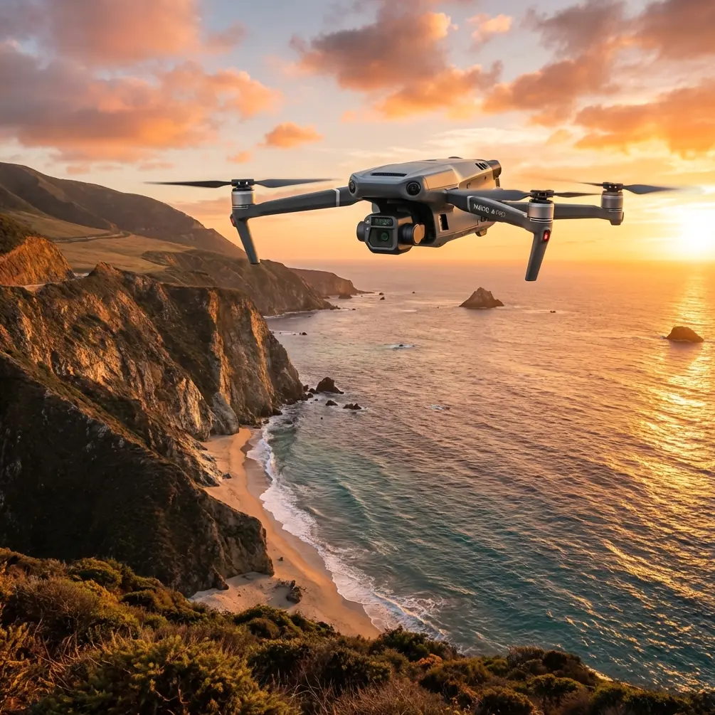
- The DJI Mavic 3T combines a 48MP wide camera, 56× zoom camera, and a 640×512 thermal sensor on a single platform purpose-built for enterprise scouting missions across challenging vineyard terrain.
- Pre-flight sensor cleaning is a critical but often overlooked safety step that directly impacts thermal signature accuracy and photogrammetry output quality.
- O3 transmission technology delivers 15 km of reliable HD video feed, enabling efficient BVLOS-capable operations across sprawling vineyard parcels.
- Hot-swap batteries and robust flight autonomy of up to 45 minutes allow operators to cover 200+ hectares per session without costly downtime.
Why Vineyard Scouting Demands a Multi-Sensor Drone
Vineyard managers operating across hilly, terraced, or otherwise complex terrain face a problem that traditional scouting methods cannot solve efficiently: they need simultaneous visual, zoom, and thermal data captured in a single pass to identify irrigation stress, canopy health anomalies, and pest hotspots before damage becomes irreversible. The Mavic 3T was engineered precisely for this kind of multi-layered intelligence gathering—and this technical review breaks down every capability that matters for viticulture professionals.
Grapevines are notoriously sensitive to micro-environmental changes. A two-degree temperature differential across a hillside canopy can signal the early onset of downy mildew or uneven water distribution. Ground-level scouting catches these signs too late. Satellite imagery lacks the spatial and thermal resolution needed. The Mavic 3T fills this gap with enterprise-grade sensors in a 920g airframe that a single operator can deploy from between vine rows.
The Pre-Flight Cleaning Step You Cannot Skip
Here is something most operators learn the hard way: a single fingerprint smudge on the Mavic 3T's thermal lens can create a false thermal signature that mimics a canopy stress pattern. Before every vineyard mission, I follow a strict pre-flight cleaning protocol that takes under three minutes but prevents hours of corrupted data analysis.
Cleaning Protocol for Sensor Accuracy
- Thermal lens: Use a microfiber cloth with zero cleaning solution. Residue from sprays can leave an IR-reflective film that distorts emissivity readings by up to 8%.
- Wide-angle and zoom lenses: A lens pen with a carbon cleaning tip removes dust without scratching the optical coatings.
- Gimbal assembly: Inspect for fine vineyard debris (pollen, dried soil particulate) lodged near the gimbal motors. Even minor friction introduces vibration artifacts into photogrammetry datasets.
- Obstacle avoidance sensors: Wipe all six directions of the omnidirectional sensing array. Dirty proximity sensors can trigger false obstacle warnings mid-flight, causing the aircraft to halt autonomously—a serious concern when operating near trellis wires at low altitude.
- Propellers and motor mounts: Check for residual moisture or mineral deposits, especially after flights near irrigated zones.
Expert Insight: I have encountered multiple cases where thermal anomaly maps showed "hotspots" that turned out to be lens contamination artifacts. In vineyard scouting, your pre-flight cleaning routine is as much a data-quality measure as it is a safety measure. Build it into your SOP and never fly without it.
This protocol also ties directly into the Mavic 3T's safety architecture. The aircraft relies on its omnidirectional obstacle sensing system to navigate autonomously around trellis posts, end-row stakes, and overhead canopy wires. When those sensors are obscured by dust or pollen, the entire obstacle avoidance system—rated for detection distances up to 40 meters—is compromised.
Triple-Sensor Payload: Technical Breakdown
The Mavic 3T's defining advantage is its triple-sensor gimbal configuration. Let's break down each sensor and its specific role in vineyard scouting workflows.
1. Wide-Angle Camera (48MP, 1/2" CMOS)
This sensor captures 8192×6144 resolution images ideal for generating high-resolution orthomosaics. For vineyard photogrammetry missions, this translates to a ground sampling distance (GSD) of approximately 1.2 cm/px at a 60-meter AGL flight altitude. That resolution is sufficient to count individual grape clusters, identify missing vines, and measure canopy gaps across entire parcels.
2. 56× Hybrid Zoom Camera (12MP)
When the wide-angle camera flags an anomaly during an automated grid mission, the zoom lens allows operators to investigate in real time without descending or breaking the flight path. At 56× zoom, an operator flying at regulatory altitude can read the text on a vineyard row marker from 800 meters away. This capability is invaluable for verifying GCP (Ground Control Point) marker placement without landing.
3. Thermal Camera (640×512, Uncooled VOx)
The DFOV (Dual Field of View) thermal sensor operates at 30 Hz with a thermal sensitivity of ≤50 mK (NETD). For vineyard scouting, this means the Mavic 3T can detect a temperature variation as small as 0.05°C between adjacent vine rows—enough to identify early-stage water stress, blocked drip emitters, or fungal infection zones that are invisible to the naked eye.
The thermal sensor supports point, area, and line temperature measurement modes, with real-time overlay on the visible-light feed. This split-screen thermal signature analysis lets the operator correlate a thermal anomaly with its visible context instantly.
Technical Comparison: Mavic 3T vs. Competing Enterprise Platforms
| Feature | Mavic 3T | Enterprise Platform A | Enterprise Platform B |
|---|---|---|---|
| Weight | 920g | 1,390g | 2,100g |
| Thermal Resolution | 640×512 | 640×512 | 320×256 |
| Thermal Sensitivity (NETD) | ≤50 mK | ≤50 mK | ≤60 mK |
| Max Flight Time | 45 min | 38 min | 32 min |
| Zoom Capability | 56× Hybrid | 32× Hybrid | 30× Digital |
| Transmission Range | 15 km (O3) | 12 km | 8 km |
| Obstacle Sensing | Omnidirectional | Forward/Backward | Forward Only |
| Data Encryption | AES-256 | AES-256 | AES-128 |
| Hot-Swap Batteries | Yes | No | No |
| RTK Module Support | Yes | Yes | No |
The comparison reveals critical advantages. The Mavic 3T's 920g weight makes it the lightest platform with full thermal and zoom capabilities, a decisive factor when hiking between vineyard parcels on steep terrain. Its hot-swap battery design eliminates the need to power down between flights, preserving your RTK calibration and mission continuity.
Transmission, Security, and BVLOS Considerations
O3 Enterprise Transmission
DJI's O3 transmission system delivers 1080p/30fps live feed at distances up to 15 km with auto-switching between 2.4 GHz and 5.8 GHz frequencies. In vineyard environments where terrain undulation and dense canopy can attenuate signal, this dual-band capability prevents the feed dropouts that plague single-band systems.
For large-estate vineyard operations, this range enables practical BVLOS (Beyond Visual Line of Sight) scouting—subject to local regulatory approval—where a single operator can survey parcels spread across multiple hillsides without relocating the takeoff point.
AES-256 Encryption
All data transmitted between the Mavic 3T and the DJI RC Pro Enterprise controller is encrypted with AES-256 protocols. For vineyard operations managed by large wine producers or agricultural cooperatives, this ensures that proprietary yield data, canopy health maps, and irrigation analysis remain secure from interception. Local data mode can also be activated to prevent any data exchange with external servers.
Pro Tip: When planning BVLOS vineyard missions, establish your GCP network using the zoom camera for visual verification before switching to autonomous grid mode. Place GCPs at elevation transitions—ridge crests and valley floors—to maximize your photogrammetry model's vertical accuracy. The Mavic 3T's RTK module support can achieve horizontal positioning accuracy of ±1 cm, but only when your GCP distribution accounts for the terrain's geometric complexity.
Photogrammetry Workflow for Vineyard Mapping
A complete vineyard photogrammetry workflow with the Mavic 3T follows this sequence:
- GCP Deployment: Place a minimum of 5 GCPs per 10-hectare block, surveyed with RTK GPS.
- Mission Planning: Configure a grid flight in DJI Pilot 2 at 60m AGL with 75% frontal overlap and 70% side overlap for the wide-angle camera.
- Simultaneous Thermal Capture: Enable synchronized thermal capture to generate co-registered RGB and thermal datasets.
- Processing: Import into photogrammetry software (Pix4D, DJI Terra, or Agisoft Metashape) to produce orthomosaics, DSMs, and thermal index maps.
- Analysis: Apply NDVI-proxy algorithms to wide-angle imagery and overlay thermal stress maps to create actionable vineyard management zones.
This workflow produces outputs with GSD values that are 4–8× higher resolution than satellite alternatives, updated on your schedule rather than waiting for cloud-free satellite passes.
Common Mistakes to Avoid
- Flying too high for thermal accuracy: Above 80m AGL, the Mavic 3T's thermal pixel footprint exceeds 12 cm, which is too coarse to isolate individual vine stress. Stay between 40–60m for actionable thermal data.
- Ignoring wind speed at canopy level: Hilltop vineyards generate turbulent updrafts. The Mavic 3T handles Level 6 winds (~12 m/s), but flying in gusty conditions introduces motion blur that degrades photogrammetry stitching quality.
- Skipping the pre-flight sensor cleaning: As detailed above, contaminated lenses produce corrupted thermal signatures that waste post-processing time and lead to false management decisions.
- Using JPEG instead of RAW for photogrammetry: Always capture in DNG (RAW) format. JPEG compression artifacts reduce tie-point accuracy in photogrammetry software by up to 15%.
- Neglecting battery temperature: Thermal camera calibration is affected by ambient and battery heat. Allow the Mavic 3T to hover for 60 seconds after takeoff before starting thermal capture. This lets the sensor's internal NUC (Non-Uniformity Correction) stabilize.
- Forgetting to calibrate emissivity for grape canopy: Default emissivity settings (0.95) are optimized for building materials. Grapevine canopy emissivity is closer to 0.97–0.98. Adjust this in the thermal settings before flight to avoid systematic temperature underreading.
Frequently Asked Questions
Can the Mavic 3T detect vine diseases before visible symptoms appear?
Yes. The 640×512 thermal sensor with ≤50 mK sensitivity can identify temperature anomalies caused by early-stage infections like Esca or Flavescence dorée 7–14 days before visible leaf symptoms manifest. Infected vines exhibit altered transpiration patterns that produce measurable thermal signature deviations of 0.3–1.2°C compared to healthy neighboring plants.
How many hectares can the Mavic 3T cover in a single battery cycle during a vineyard photogrammetry mission?
At a standard photogrammetry altitude of 60m AGL with 75/70% overlap and a flight speed of 8 m/s, the Mavic 3T covers approximately 50–60 hectares per battery. With hot-swap batteries, you can continuously cover 200+ hectares per session without powering down or recalibrating your mission parameters.
Is the Mavic 3T suitable for vineyard scouting in mountainous or steep terrain?
The Mavic 3T is exceptionally well-suited for complex terrain. Its omnidirectional obstacle sensing detects trellis wires and poles up to 40 meters away. The terrain follow mode in DJI Pilot 2 maintains consistent AGL altitude across elevation changes, which is essential for uniform GSD in photogrammetry and accurate thermal readings. The compact 920g frame also means the operator can easily carry the system between remote vineyard parcels that heavier platforms cannot access.
Ready for your own Mavic 3T? Contact our team for expert consultation.