How to Use the Mavic 3T for Remote Field Spraying Support
How to Use the Mavic 3T for Remote Field Spraying Support
META: Practical how-to for using the DJI Mavic 3T to scout remote fields before spraying, using thermal imaging, O3 transmission, AES-256 security, and efficient battery workflows.
By Dr. Lisa Wang, Specialist
Spraying fields in remote areas is rarely just about getting liquid on crop. The hard part is knowing where to spray, where to avoid, and how to make those decisions fast enough that the field conditions have not changed by the time the team moves in.
That is where the Mavic 3T earns its place.
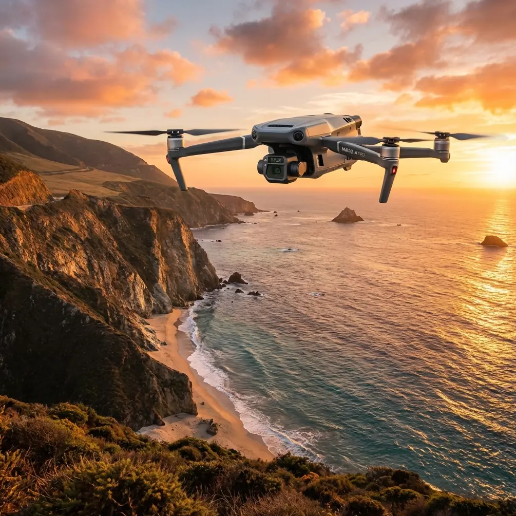
Let’s be precise from the start. The Mavic 3T is not a spray drone. It is a compact thermal-capable aircraft that can make remote spraying operations far more accurate, safer for the field environment, and less wasteful. Used properly, it becomes the aircraft that flies first, checks access, spots wet patches, reveals heat differences, verifies boundary conditions, and helps a ground or agricultural spray team act with confidence.
If your challenge is spraying fields in remote country, this is how to use the Mavic 3T as the intelligence layer before, during, and after the job.
Start with the real problem, not the aircraft
Remote spraying creates a chain of uncertainty.
You may have weak road access. Field edges might be unclear. Waterlogging can change wheel-entry decisions. Crop stress may not show evenly in visible light. Wildlife can be hidden in grass or brush. Communication can drop out just when the pilot needs confirmation from the spray crew. And if the field is several kilometers from the operator’s launch point, every minute of battery time has to matter.
The Mavic 3T helps because it combines visual imaging, thermal signature detection, stable transmission, and fast deployment in one small platform. Instead of sending people to walk uncertain ground first, you can get an aerial answer quickly.
That changes the economics of the whole task. The goal is not simply “fly a drone.” The goal is to reduce unnecessary passes, avoid sensitive areas, and help the spraying team cover the right hectares under the right conditions.
Step 1: Use the Mavic 3T as a pre-spray reconnaissance tool
Before any spraying begins, launch the Mavic 3T to build a field reality check.
In remote operations, maps are often less trustworthy than people assume. Boundaries shift. Temporary pooling appears after weather events. Tracks that looked usable last week may be impassable now. If you send a spray vehicle or crew in blind, you lose time and increase risk.
A simple pre-spray flight should answer five questions:
- Where is the exact treatment area today?
- Are there wet zones, washouts, or access hazards?
- Is crop stress uniform or localized?
- Are there people, animals, or non-target areas nearby?
- Can the communication link remain stable from the chosen launch site?
This is where the Mavic 3T’s thermal capability matters. A visible camera shows texture and color. Thermal shows temperature contrast. That contrast can reveal irrigation irregularities, standing moisture, drainage patterns, and stress zones that deserve more attention before a spray plan is finalized.
Not every agronomic decision should be made from thermal alone, of course. But thermal gives you another layer of truth when visible imagery is ambiguous, especially early in the morning or near dusk when temperature separation can be clearer.
Step 2: Time thermal flights when the field is readable
Operators often make the mistake of flying thermal whenever convenient. That wastes one of the Mavic 3T’s strongest advantages.
Thermal signature data is most useful when environmental conditions help target features separate from the background. In field work, that often means flying when the ground, crop canopy, wet zones, and surrounding objects are not all blending into the same temperature band.
For remote spraying support, use thermal to identify:
- Cooler wet patches that may affect vehicle access
- Uneven plant stress patterns
- Irrigation leaks or water distribution anomalies
- Areas where vegetation density differs from the surrounding stand
- Hidden obstructions or animals in edge zones
One morning on a remote field margin, a team preparing a treatment run found what looked like a routine grassy drainage strip from the RGB view. On thermal, there was a distinct warm cluster near the edge. The pilot held position, zoomed, and confirmed a small deer and fawn tucked down in cover. The spray team adjusted the route and delayed work in that section until the animals moved off. That is a good example of why thermal is not just a sensor spec on a brochure. It changes operational judgment.
Step 3: Build a quick field map when boundaries are uncertain
The Mavic 3T is not the first aircraft most surveyors choose for high-accuracy large-area photogrammetry, but in remote agricultural work it can still play a useful role in creating rapid situational mapping.
If the field edge is unclear, or if operators need a current overhead reference before spraying, a structured image capture can create a practical base map. That map may help define treatment zones, staging areas, turning points, and exclusion buffers.
If you are collecting imagery for measurement or alignment, think like a mapping professional:
- Maintain consistent altitude
- Use sufficient overlap
- Plan repeatable flight lines
- Mark important edge references on the ground where feasible
- Use GCPs if positional confidence matters
Ground Control Points are especially relevant when the field has poor existing map references or when teams need to compare imagery against prior records. GCPs are not always necessary for a simple scouting flight, but they become valuable when the image output will inform operational boundaries or post-job documentation.
This matters because spraying errors often come from bad spatial assumptions, not bad application equipment. A reliable overhead reference reduces that risk.
Step 4: Choose launch and observation points around O3 transmission realities
Remote fields often challenge connectivity. Tree lines, ridges, utility structures, and distance all affect link quality. The Mavic 3T benefits from O3 transmission, which is a major operational advantage because it supports a stable, high-quality feed at distance when line of sight is managed properly.
That does not mean you can ignore field geometry.
For a remote spraying support mission, pick a launch area with:
- Clean line of sight into the main treatment block
- Minimal RF interference
- Enough room for safe takeoff and landing
- Vehicle access for battery rotation
- A clear view of likely trouble spots such as drainage channels or isolated corners
O3 transmission matters in practice because scouting flights are only useful if the pilot can interpret live imagery confidently. When a team is deciding whether a low-lying section is too wet for equipment or whether a boundary row should be excluded, a clean feed is not a luxury. It is the basis for an operational call.
If your team is working in areas where mobile signal is weak and logistics are slow, having a dependable aircraft-to-controller link becomes even more critical. You do not want to discover image issues after landing when the spray crew is already waiting.
Step 5: Protect agronomic and client data with AES-256 workflows
Remote agriculture is not just about flying over crops. It often involves sensitive data: field condition records, treatment zones, client land information, and imagery tied to farm operations.
The Mavic 3T’s AES-256 security support matters here. For contractors and enterprise users, this is not abstract IT language. It means the data path and platform workflow can better align with organizations that care about information control.
Why does that matter in spraying support?
Because field imagery can reveal planting patterns, infrastructure layout, irrigation design, storage locations, and operational timing. In commercial agriculture, that information is valuable. If you are handling scouting, mapping, or treatment planning for growers, secure practices build trust.
At minimum, teams should pair platform security with disciplined operational habits:
- Control who handles memory cards
- Standardize file naming and transfer protocols
- Separate client jobs clearly
- Archive flight records with date, field ID, and mission purpose
- Limit unnecessary sharing of raw imagery
A secure drone does not replace good process. It strengthens it.
Step 6: Plan battery workflow like a field operation, not a demo flight
Remote work punishes poor energy planning.
The Mavic 3T is compact, but that should not tempt you into casual battery management. In field support roles, every launch should have a purpose: scout access, inspect crop variation, confirm exclusion areas, document completion, or re-check a changing condition.
This is where a disciplined battery rotation approach pays off. Many remote teams refer informally to “hot-swap batteries” when they mean rapid turnaround between flights with charged packs staged and ready. The point is not literal mid-air battery replacement. The point is minimizing downtime on the ground.
A good remote spraying support kit includes:
- Multiple fully charged flight batteries
- Vehicle charging strategy if mains power is unavailable
- A written flight priority list
- Weather-aware mission sequencing
- Battery tagging so degraded packs are identified early
The operational significance is simple. If a weather window is narrow and your first reconnaissance flight reveals a drainage issue on the far side of the block, you may need another immediate launch to inspect a second entry route. Teams that treat batteries as an afterthought lose the tempo advantage the Mavic 3T can provide.
Step 7: Keep BVLOS ambitions separate from legal reality
In very large or isolated farm areas, operators naturally think about BVLOS because the fields can stretch far beyond comfortable visual range. The Mavic 3T is certainly capable enough to make long-range work tempting.
But capability is not authorization.
If your spraying support concept involves Beyond Visual Line of Sight operations, that must be approached through the applicable civil aviation framework, approvals, risk assessment, and operating procedures in your region. For most agricultural teams, the practical path is to optimize launch location, observer placement, and mission segmentation rather than casually extending beyond compliant operations.
This is worth saying because remote field jobs create pressure to “just push a little farther.” That usually leads to degraded situational awareness right when the aircraft is over the least accessible terrain.
A well-planned legal VLOS mission often outperforms a poorly controlled long-distance one.
Step 8: Use the Mavic 3T after spraying, not just before
Post-application flights are often overlooked.
Once treatment is complete, the Mavic 3T can document field condition, verify access impacts, and identify anomalies worth revisiting. Thermal does not directly confirm chemical efficacy in a simplistic way, but it can still assist in spotting irrigation issues, heat-related stress concentrations, or field sections behaving differently from neighboring areas.
That post-job record becomes valuable when:
- The grower wants a documented overview of the treated block
- The team needs proof of field conditions at the time of operation
- Access damage concerns need review
- A follow-up agronomy visit is being planned
For contractors, this creates a cleaner operational chain: scout, support, document, compare.
A practical mission template for remote field spraying support
Here is a usable sequence many teams can adapt:
1. Arrive and assess launch options
Choose a site with strong line of sight and vehicle support.
2. Conduct a fast RGB overview flight
Confirm field boundaries, access tracks, obstacles, and staging routes.
3. Fly targeted thermal passes
Inspect low areas, suspected stress patches, edge habitat, and drainage features.
4. Mark operational notes
Identify no-go zones, soft ground, wildlife observations, and route changes.
5. Share findings with the spray team
If you need direct coordination on setup or deployment, send your field notes here: https://wa.me/85255379740
6. Support active operations if needed
Launch again to verify an alternate entry route or re-check a questionable section.
7. Perform a post-job documentation flight
Capture the current state of the field and archive imagery by block and date.
That workflow is not complicated, which is exactly why it works.
Where the Mavic 3T fits best
The Mavic 3T is especially effective in remote spraying support when the operation needs mobility more than heavy payload. You can carry it into difficult access areas, launch quickly, gather both visible and thermal data, and give the spray team a much sharper picture of what the field is actually doing that day.
Its value is highest when:
- The field changes quickly after weather events
- Access routes are uncertain
- Wildlife or non-target edge zones need checking
- The crew must make decisions with limited ground visibility
- Documentation matters for commercial accountability
The mistake is expecting it to replace every other agricultural aircraft. It will not. The better view is this: the Mavic 3T reduces uncertainty before the sprayer moves and improves field awareness while the job is unfolding.
That alone can save wasted passes, unnecessary vehicle movement, and avoidable mistakes in remote terrain.
For teams spraying fields far from easy access, that is not a nice extra. It is operational discipline with better eyes.
Ready for your own Mavic 3T? Contact our team for expert consultation.