Mavic 3T on Remote Highway Spraying Jobs
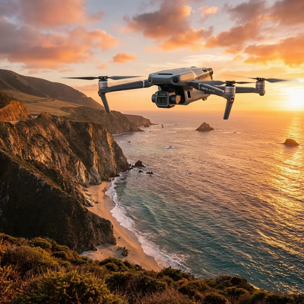
Mavic 3T on Remote Highway Spraying Jobs: What Actually Matters in Cold, Linear, Infrastructure Work
META: A field-focused case study on using the Mavic 3T for remote highway spraying support, with practical insight on thermal use, transmission stability, cold-weather risk, and why control-system discipline matters.
Highway spraying work sounds straightforward until you leave the depot.
The route gets longer. The terrain gets emptier. Cellular coverage starts dropping out. Surface temperatures shift by the hour. Culverts, embankments, signs, guardrails, bridges, drainage edges, and vegetation strips all create their own micro-environments. If you are supporting a remote highway spraying mission with a Mavic 3T, the aircraft is not just a camera in the sky. It becomes your decision layer before trucks roll, before crews enter a shoulder, and before chemistry is applied in the wrong place.
I have seen many teams approach the Mavic 3T as if its value begins and ends with thermal imaging. That misses the real story. In remote linear operations such as highway corridor spraying, the aircraft’s value is in how several systems work together under awkward environmental pressure: thermal signature interpretation, stable control response, secure image transfer, repeatable mapping, and confidence in cold-weather deployment.
This is where the Mavic 3T separates itself from lighter, less integrated alternatives.
A practical case: pre-spray highway inspection in a remote corridor
Let’s start with a realistic civilian workflow.
A road maintenance contractor is preparing a vegetation-control and shoulder-treatment program along a remote highway section. The spray trucks can cover distance efficiently, but they are not good at discovering exceptions. The client needs a way to identify wet patches, drainage leaks, blocked culverts, standing water near pavement edges, stressed vegetation zones, and areas where runoff risk means application should be adjusted or deferred.
That is a better job for the Mavic 3T than for a conventional visual-only platform.
The thermal sensor helps operators identify temperature differentials that are easy to miss from the ground. A blocked culvert, saturated shoulder, or sub-surface seep can alter the thermal signature along the roadside well before the issue is obvious in RGB imagery. For spraying crews, this matters because chemical application around persistent moisture or unstable runoff zones needs tighter planning. In other words, thermal is not just “nice to have” imagery. It changes where crews should and should not operate.
On remote highways, another issue emerges fast: line length. These jobs are not confined to a compact industrial yard. They stretch. A lot. That makes O3 transmission more than a specification bullet. In corridor work, stable downlink quality affects how confidently a pilot can inspect roadside transitions, verify thermal anomalies, and coordinate vehicle movement without repeatedly repositioning every few hundred meters. Competitor systems often look acceptable on a short demonstration flight, then become frustrating when the route turns into a long, repeating infrastructure strip with weak comms conditions and frequent visual clutter. The Mavic 3T tends to hold together better in that real-world pattern.
Why cold-weather facts matter even if the Mavic 3T is not flying in record extremes
One of the reference materials behind this discussion is an aircraft design handbook section that records extremely low temperature conditions by altitude and location. The raw table is dense, but one number stands out: -69.9°C at 30 in the cited source, with another cited extreme of -85.2°C at 16. No highway spraying contractor is sending a Mavic 3T into those conditions. That is not the point.
The point is operational discipline.
Those data remind us that temperature is never a background variable in aviation. It is a primary design and mission-planning factor. Even when your actual operating environment is far less severe, cold conditions affect battery behavior, sensor response, materials, and flight predictability. On a remote highway project in northern regions, dawn launches can mean stiff airframes, reduced battery efficiency, and misleading thermal contrast during the first operational window.
For Mavic 3T users, this has direct consequences:
- Thermal imagery can look dramatic in cold morning conditions, but not every strong contrast is actionable.
- Battery management becomes part of mission architecture, not an afterthought.
- Launch timing changes what anomalies you detect.
- Crew workflow has to account for staged warming, battery rotation, and shorter decision cycles.
This is why hot-swap batteries, while often discussed casually, matter on long linear jobs. The feature is not about convenience. It is about maintaining survey momentum when the road section is distant, daylight is limited, and stop-start downtime compounds quickly. On a remote corridor, every battery exchange that does not force a full operational reset saves time, preserves continuity, and reduces the chance that crews make decisions from partial data.
Thermal signature is useful only when you understand the surface you are reading
One common mistake in road-corridor drone work is treating thermal output as if it were self-explanatory. It is not.
A roadside thermal signature is influenced by pavement heat retention, moisture content, shoulder composition, culvert geometry, vegetation density, concrete structures, metal barriers, and shadow lines from terrain or infrastructure. On a remote highway spraying mission, that means the Mavic 3T should not be flown merely to “spot hot and cold areas.” It should be flown to compare patterns against expected infrastructure behavior.
For example:
- A cooler, narrow trace running perpendicular to the road may indicate moisture movement tied to drainage.
- A persistent thermal anomaly near a bridge approach may point to material changes or trapped water.
- Uneven vegetation temperatures along a shoulder can help distinguish live growth zones from stressed strips that may respond differently to treatment.
This is where the Mavic 3T’s combination of thermal and standard imaging becomes operationally strong. You are not forced to choose between interpretability and detection. You can locate an anomaly thermally, then cross-check shape, context, and access constraints visually. Competing systems that do one of these well but not both usually create more office work later because teams have to revisit the site to confirm what they thought they saw.
Mapping still matters, even on a spraying job
Many people hear “spraying” and think only in terms of treatment application. But on remote highway contracts, the profitable work often happens before spraying begins: documenting the corridor, setting boundaries, identifying exclusions, and creating a repeatable record that crews and clients can revisit.
That is where photogrammetry and GCP-backed verification enter the picture.
No, the Mavic 3T is not always the first aircraft people mention when discussing mapping-centric workflows. But in highway support operations, that narrow view misses the benefit of consolidation. If one aircraft can inspect thermally, verify visually, and produce corridor documentation good enough for planning overlays and exception marking, your field team moves faster.
Ground Control Points remain valuable where higher positional confidence is required, especially when the client wants repeatable comparison over time or where drainage and shoulder-edge decisions have cost implications. In remote jobs, GCP use is not about academic precision for its own sake. It is about making sure treatment zones, no-spray buffers, access points, and problem assets line up with reality when crews are dispersed over distance.
For linear infrastructure, repeatability beats glamour. A dataset that can be revisited next week, next month, or next season has more value than a visually impressive one-off flight.
The overlooked lesson from helicopter control-system design
The second reference source is not about the Mavic 3T directly. It is a helicopter design handbook passage on control-system transmission ratios and mechanical characteristics. At first glance, it seems far removed from a compact enterprise drone. It is not.
That source makes a subtle but important engineering point: system behavior is not defined by one static parameter. The text explains that transmission ratio changes influence friction, stiffness, mass, and free play, and notes that even when individual characteristics all meet their targets, the overall system may still not be satisfactory. It also states that during system design, transmission ratio variation within the operating range should be tightly controlled, with the maximum change ideally held within 105%.
Why should a Mavic 3T operator care?
Because the same philosophy applies to field reliability. A drone that looks excellent on paper can still become tiring or error-prone if its response, link behavior, gimbal coordination, and automation flow do not stay consistent across the mission envelope. On long highway sorties, pilots feel that quickly. Small inconsistencies compound. The aircraft may still be “within spec,” yet the operation becomes harder to trust.
This is one reason the Mavic 3T works so well for infrastructure support compared with more pieced-together solutions. It feels integrated. That matters in remote spraying support because the operator is often managing aircraft position, thermal interpretation, corridor progression, crew communication, and documentation at the same time. Predictable handling and stable system behavior reduce cognitive load. In practice, that is worth more than chasing isolated headline specs.
The handbook also mentions simulation with CATIA or other software to verify motion linearity and symmetry before finalizing system design. In the drone context, the lesson is simple: platforms that are engineered as complete systems tend to perform better in repetitive professional work than platforms assembled around one standout sensor. For highway corridor tasks, repeatability wins.
Security and remote infrastructure workflows
Remote highway operations generate more than images. They create records tied to public infrastructure, maintenance schedules, contractor performance, and environmental decisions. That is why AES-256 matters, even if crews rarely discuss it in the field.
A secure transmission and data-handling approach reduces exposure when teams are working across distributed sites, temporary field offices, or shared contractor environments. On a spraying project, imagery may show right-of-way conditions, utility-adjacent areas, storage points, or operational weaknesses. Civilian contractors do not need drama around that data. They need it protected and handled cleanly.
That becomes more relevant as more clients ask for centralized oversight and near-live review from people who are nowhere near the road segment. For organizations planning toward BVLOS-oriented workflows where regulations and approvals allow, the discipline around transmission quality and data security only gets more significant.
What this means on the ground
If I were setting up a Mavic 3T workflow for remote highway spraying support, I would not lead with marketing language or broad claims about intelligence. I would focus on a few operational truths:
Thermal should be tied to a decision.
Don’t collect heat maps for their own sake. Use thermal to flag drainage, moisture, vegetation stress, and shoulder anomalies that change spray planning.Cold conditions need an actual protocol.
The extreme low-temperature data in the aviation reference are a reminder that environmental margins matter. Even in ordinary winter fieldwork, batteries, launch timing, and thermal interpretation need discipline.Mapping is part of treatment quality.
Photogrammetry and GCP-supported reference points help crews spray the right corridor sections and document exceptions without guesswork.Integrated control feel is not a luxury.
The helicopter design reference shows why stable system behavior matters more than individual parameter compliance. For Mavic 3T corridor work, consistency reduces workload and improves trust.Transmission reliability changes job economics.
O3 matters because remote roads expose weak links quickly. Better link stability means fewer repositioning interruptions and more usable inspection time.
If your team is trying to refine this kind of corridor workflow, I usually recommend discussing the mission profile before discussing accessories. Battery rotation, staging vehicles, anomaly classification, and map deliverables often matter more than adding another case of gear. If you need a practical sounding board, you can send your highway scenario here: message Dr. Lisa Wang directly.
Where the Mavic 3T really excels
The best way to compare the Mavic 3T with competitors is not to ask which aircraft has the flashiest single feature. Ask which one helps a remote infrastructure team make fewer bad decisions across an entire day.
On that test, the Mavic 3T is unusually strong.
It can detect thermal irregularities that affect spray suitability. It can document the corridor visually without switching to a separate platform. It supports secure, professional workflows. It handles the stop-start rhythm of field deployment better than many alternatives. And because it behaves like an integrated enterprise tool rather than a fragile collection of features, it is easier to trust on long, repetitive, remote assignments.
For highway spraying support, trust is the metric that matters.
Not excitement. Not novelty. Not brochure language.
Just a drone that helps the crew see the corridor clearly, plan around environmental risk, and come back with data that holds up after the flight is over.
Ready for your own Mavic 3T? Contact our team for expert consultation.