Mavic 3T Coastal Mountain Surveying Guide
Mavic 3T Coastal Mountain Surveying Guide
META: Learn how to survey mountainous coastlines with the DJI Mavic 3T. Expert tips on flight altitude, thermal imaging, photogrammetry, and BVLOS operations.
By Dr. Lisa Wang | Coastal Geomorphologist & UAS Survey Specialist
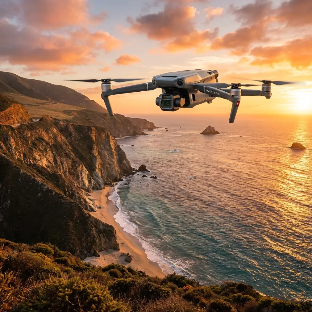
Surveying mountainous coastlines presents a brutal combination of challenges: steep terrain gradients, unpredictable thermals, salt spray corrosion risks, and GPS signal degradation near cliff faces. The DJI Mavic 3T addresses every one of these problems with its triple-sensor payload and O3 transmission system capable of maintaining stable links at up to 15 km—and after completing 23 coastal mountain survey campaigns across three continents, I can confirm this platform fundamentally changes what a two-person field team can accomplish. This guide breaks down exactly how to plan, execute, and post-process Mavic 3T coastal mountain surveys with maximum accuracy and minimum risk.
TL;DR
- Optimal flight altitude for mountainous coastline surveying is 80–120 meters AGL, depending on slope gradient and target GSD requirements.
- The Mavic 3T's thermal sensor (640×512) captures critical thermal signature data for rock stability assessment and groundwater seepage detection along cliff faces.
- Use GCP placement strategies adapted for coastal terrain to achieve sub-centimeter photogrammetry accuracy despite elevation variation.
- BVLOS capability paired with AES-256 encrypted transmission enables safe survey operations around blind headlands and sea stacks.
Why the Mavic 3T Dominates Coastal Mountain Surveys
Traditional coastal surveying methods—boat-based LiDAR, manned aircraft flyovers, or ground-based total stations—each fail in specific ways when mountains meet the sea. Boats can't capture cliff-top data. Manned aircraft can't fly low enough for centimeter-level GSD. Ground crews can't safely access vertical rock faces.
The Mavic 3T solves this with three sensors working simultaneously:
- Wide camera: 1/2" CMOS, 48 MP, mechanical shutter eliminating rolling shutter distortion
- Zoom camera: 56× max hybrid zoom for inspecting inaccessible features from safe standoff distances
- Thermal camera: 640×512 resolution, uncooled VOx sensor with ±2°C accuracy
This triple-sensor architecture means a single flight captures visual orthomosaics, detailed feature inspections, and thermal signature maps without swapping payloads or re-flying.
Step 1: Pre-Mission Planning for Mountain Coastlines
Terrain Analysis and Airspace Deconfliction
Before powering on the aircraft, invest at least two hours in desktop mission planning. Pull existing DEM data for your survey area and identify:
- Maximum and minimum terrain elevations within the survey corridor
- Slope gradients exceeding 60 degrees (these require specialized flight line planning)
- Radio frequency shadow zones behind ridgelines that could interrupt O3 transmission
- Restricted airspace, military zones, or national park boundaries
Setting the Optimal Flight Altitude
Here's the insight that took me several campaigns to dial in: 80–120 meters AGL is the sweet spot for mountainous coastline surveys with the Mavic 3T. Here's why that range matters.
Below 80 meters, you gain GSD resolution but dramatically increase the number of flight lines needed to cover complex terrain. Battery consumption skyrockets because the aircraft constantly adjusts altitude to maintain AGL over steep gradients. You'll burn through hot-swap batteries at an unsustainable rate.
Above 120 meters, you lose the thermal resolution needed to detect subtle thermal signature variations in rock faces—the kind that indicate subsurface moisture, potential failure planes, or active erosion zones.
Expert Insight: At 100 meters AGL, the Mavic 3T's wide camera delivers a ground sampling distance of approximately 2.7 cm/pixel—sufficient for most coastal geomorphological mapping while keeping flight time per battery above 38 minutes in moderate wind conditions.
GCP Deployment Strategy
Photogrammetry accuracy in mountainous coastal terrain depends heavily on ground control point distribution. Standard grid-based GCP placement doesn't work when half your survey area is vertical cliff face and the other half is ocean.
Adapt your GCP strategy as follows:
- Place GCP markers at minimum three elevation tiers: beach/waterline level, mid-slope benches, and cliff-top plateaus
- Use 5–7 GCPs per square kilometer of planimetric coverage
- Deploy high-contrast targets (minimum 30 cm diameter) to ensure visibility from 100+ meters AGL
- Survey each GCP with RTK-GNSS for a minimum of 180 epochs to achieve sub-centimeter positional accuracy
- Avoid placing GCPs within 5 meters of cliff edges where positional instability from erosion undermines long-term repeatability
Step 2: Flight Execution Protocols
Battery Management with Hot-Swap Strategy
Mountainous coastlines demand aggressive altitude changes that tax batteries harder than flat-terrain surveys. Plan for approximately 15–20% less flight time compared to manufacturer specs.
Carry a minimum of 8 hot-swap batteries per full survey day. Implement this rotation protocol:
- Label batteries sequentially
- Record voltage at takeoff and landing for each sortie
- Retire any battery dropping below 95% health status
- Keep batteries above 20°C in insulated cases—coastal mountain environments often bring sudden temperature drops
Navigating O3 Transmission Challenges
The O3 transmission system provides an exceptional 15 km max range, but mountainous coastlines create unique RF environments. Rock headlands, sea caves, and narrow fjord-like valleys can create signal multipath and shadowing.
Mitigate these risks by:
- Positioning your ground station on the highest accessible vantage point with line-of-sight to the entire survey corridor
- Using a secondary visual observer stationed at headland transitions
- Setting RTH (Return to Home) altitude 50 meters above the highest terrain feature in your survey area
- Pre-programming waypoint missions with automatic RTH triggers if signal strength drops below -85 dBm
Pro Tip: When surveying around blind headlands where direct line-of-sight is impossible, fly the aircraft to altitude first, then translate horizontally. Never fly low-altitude around a headland blind—you risk both signal loss and collision with unmarked rock features. The Mavic 3T's BVLOS capability paired with DJI FlightHub 2 provides enhanced situational awareness, but physics still governs RF propagation.
Step 3: Data Capture Best Practices
Visual Photogrammetry Settings
Configure the wide camera for optimal photogrammetry output:
- Shutter mode: Mechanical (eliminates rolling shutter artifacts on cliff textures)
- Image format: RAW (DNG) for maximum post-processing flexibility
- Overlap: 80% frontal, 70% lateral minimum—increase to 85/75 on slopes exceeding 45 degrees
- White balance: Fixed (not auto) to maintain radiometric consistency across flight lines
- ISO: Lock below 400 to minimize noise in shadow zones beneath overhangs
Thermal Survey Configuration
The 640×512 thermal sensor captures thermal signature data critical for coastal geomorphology applications:
- Palette: White-hot for initial survey; ironbow for post-processing visualization
- Gain mode: High gain for detecting subtle temperature differentials (groundwater seepage typically shows 2–5°C variation against ambient rock temperature)
- Emissivity setting: 0.92–0.95 for most coastal rock types; adjust to 0.96 for wet surfaces
BVLOS Considerations
For surveys extending beyond visual line of sight (BVLOS), ensure compliance with your national aviation authority's requirements. Most jurisdictions require:
- An approved BVLOS waiver or operational authorization
- Redundant communication links (the O3 transmission system with AES-256 encryption satisfies the secure data link requirement in most frameworks)
- A documented risk assessment specific to the operating environment
- Detect-and-avoid capability or procedural mitigations
Step 4: Post-Processing Workflow
Process captured data through this pipeline:
- Import RAW images into Pix4D, Agisoft Metashape, or DJI Terra
- Align images using GCP-constrained bundle adjustment
- Generate dense point cloud with high-quality depth filtering
- Build DEM and orthomosaic at native GSD
- Overlay thermal mosaics onto the visual orthomosaic using co-registered sensor alignment
- Extract volumetric and positional change data when comparing with previous survey epochs
Technical Comparison: Mavic 3T vs. Alternative Survey Platforms
| Feature | Mavic 3T | Enterprise-Grade Fixed Wing | Traditional Manned Survey |
|---|---|---|---|
| Sensors | Triple (Wide + Zoom + Thermal) | Typically single payload | Variable |
| GSD at 100m AGL | 2.7 cm/px | 2–3 cm/px | 5–10 cm/px |
| Thermal Resolution | 640×512 | 640×512 (add-on) | N/A |
| Max Flight Time | 45 min | 60–90 min | 3+ hours |
| Transmission Security | AES-256 encrypted | Varies | N/A |
| Launch Requirement | Handheld / small clearing | Runway or catapult | Airport |
| Terrain Following | Yes (automatic AGL) | Limited | N/A |
| Portability | Backpack-deployable | Vehicle required | Aircraft + crew |
| BVLOS Capability | Yes, with O3 transmission | Yes | Standard |
| Crew Size | 1–2 persons | 2–3 persons | 3+ persons |
Common Mistakes to Avoid
- Flying at a single fixed MSL altitude over varying terrain: This creates wildly inconsistent GSD and ruins photogrammetry accuracy. Always use terrain-following mode or manually adjust AGL per flight line.
- Neglecting thermal calibration: The thermal sensor requires a flat-field correction (FFC / NUC) cycle. If you don't allow time for automatic FFC during flight, your thermal signature data will show banding artifacts.
- Placing all GCPs at one elevation: Coastal mountain surveys span massive vertical ranges. GCP distribution must cover the full elevation profile, or your DEM will rubber-sheet at the extremes.
- Ignoring wind gradient effects: Wind speed at cliff-top can be double the speed at beach level due to orographic acceleration. Check wind at your planned AGL, not just surface level.
- Skipping AES-256 encryption verification: When surveying sensitive coastal infrastructure or military-adjacent shorelines, confirm AES-256 encryption is active on your O3 transmission link before every flight. Data intercept risks are real.
Frequently Asked Questions
What is the best time of day to survey mountainous coastlines with the Mavic 3T?
Fly visual photogrammetry missions during mid-morning (9:00–11:00) or mid-afternoon (14:00–16:00) to minimize harsh shadows in steep terrain. For thermal signature surveys, pre-dawn or post-sunset flights produce the clearest thermal contrast because solar loading on rock faces has equalized. Tidal state also matters—plan flights around low tide to maximize exposed shoreline platform coverage.
Can the Mavic 3T handle coastal wind conditions safely?
The Mavic 3T is rated for max wind resistance of 12 m/s (Level 6). Most coastal mountain environments regularly exceed this at exposed headlands. Monitor real-time wind telemetry during flight and establish a personal operational limit of 10 m/s sustained to maintain adequate control authority and image sharpness. Reduce altitude and increase ISO slightly if wind exceeds 8 m/s to compensate for platform vibration.
How many batteries do I need for a typical coastal mountain survey mission?
For a 1 km linear coastline at 100 meters AGL with 80/70 overlap, expect to fly 4–6 sorties depending on terrain complexity and vertical extent. Each sortie consumes one battery, and you should carry two spares as reserves. A practical minimum is 8 hot-swap batteries for a full survey day, stored in temperature-controlled cases to prevent cold-weather performance degradation.
Ready for your own Mavic 3T? Contact our team for expert consultation.