Mavic 3T in Windy Construction Surveys: A Field Report
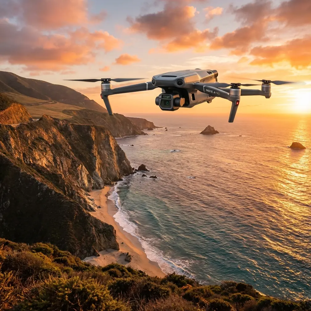
Mavic 3T in Windy Construction Surveys: A Field Report From the Edge of a Changing Forecast
META: Expert field report on using the Mavic 3T for windy construction site surveys, with practical insights on thermal signature checks, photogrammetry control, O3 transmission reliability, and weather-driven workflow decisions.
Wind changes the truth of a drone mission.
On paper, a construction survey can look clean: fixed boundaries, planned flight lines, known elevation change, tidy deliverables. In the field, especially on an exposed site with unfinished structures and open steel, the real variable is air. Gusts wrap around stair cores, roll off slab edges, and hit the aircraft differently at 20 meters than they do at 70. That is where the Mavic 3T becomes interesting—not as a brochure item, but as a working tool.
I recently used it on a construction site survey where the goal was broader than a simple visual progress check. The team needed a photogrammetry pass for stockpile and grading review, a thermal sweep to catch moisture anomalies around newly sealed roof sections, and a fast revisit capability because weather was forecast to deteriorate later in the morning. The Mavic 3T handled all three jobs in one field window, but the value came from how it handled transitions: changing wind, changing light, and changing mission priorities.
That matters more than people admit.
The real survey problem was not just mapping
Most site managers think of drone work as a single output: an orthomosaic, a progress video, maybe a 3D surface model. On this mission, the more useful question was whether the aircraft could support two different kinds of evidence at once.
The first was geometric. We needed clean overlap for photogrammetry, tied back to GCP-based control so that cut-and-fill changes and perimeter updates would remain defensible when compared with prior datasets.
The second was thermal. The site team wanted to identify inconsistent heat behavior on specific surfaces before another crew mobilized. Thermal signature work on a construction site is not the same as cinematic infrared footage. You are looking for patterns that might suggest trapped moisture, insulation inconsistencies, or equipment operating outside expected temperature ranges. The thermal view does not replace inspection judgement, but it shortens the list of places that deserve a closer look.
The Mavic 3T is one of the few compact aircraft that makes this dual-purpose workflow practical. That is its real strength on construction projects. It saves mobilization time not because it is small, but because it reduces the need to split the mission across multiple aircraft categories.
Wind exposes whether your workflow is disciplined
We launched under stable conditions. The site was open enough for a reliable initial grid, and the first portion of the photogrammetry run looked routine. Ground control had already been placed, checked, and logged. That part sounds simple, but this is where many survey flights quietly go off course. If your GCP workflow is weak, wind only amplifies the error because you start accepting marginal image geometry just to finish the mission quickly.
That was the first operational lesson from the day: in wind, you need a workflow built on standards, not improvisation.
Oddly enough, one of the most useful mental models for this comes from old aircraft design discipline rather than modern drone marketing. In the reference material, one source points to Chapter 6 on imperial threads, page 215, from an aircraft design handbook devoted to standards and standard parts. Another source highlights basic symbols, SI base units, and unit conversion tables, including measurement unit conversion on page 52. Those details may seem far removed from a Mavic 3T field mission, but they are not.
They point to something survey teams forget: precision work is protected by standardization. Thread standards matter in aviation because tiny inconsistencies can propagate into mechanical failure or maintenance confusion. Unit systems and conversion tables matter because mixed measurement logic creates bad engineering decisions. On a windy construction survey, the equivalent problem is operational inconsistency—mismatched altitude settings, sloppy overlap planning, poor control point handling, or confusion between thermal observations and survey-grade spatial products.
That is why a disciplined Mavic 3T operator treats each mission almost like a small engineering system. Wind does not forgive casual setups.
When the weather shifted mid-flight
About a third of the way into the mission, the forecast caught up with us.
The first sign was not the aircraft. It was the site itself. Loose plastic near the north boundary started snapping harder against temporary fencing, and dust movement became directional instead of random. A minute later, the aircraft attitude corrections became more visible on the live feed as it crossed the lee side of a half-finished structure. This is the moment when many pilots push through because they are close to finishing the grid.
That is a mistake.
The right move was to break the mission into priorities. We completed the most geometrically critical segment first, then reduced exposure by shortening the remaining pattern rather than forcing a perfect full-site pass in one go. The Mavic 3T’s compact form factor helped here, but more important was signal confidence. In shifting conditions, stable link behavior matters because the pilot’s decision cycle speeds up. O3 transmission gave a reliable live view when the site geometry and wind were both adding complexity. That is not just a convenience feature. It affects safety margins and data confidence when you need to judge whether image capture is still worth continuing.
This is also where AES-256 comes into the conversation in a practical way. Construction surveys often involve sensitive commercial information: staging layouts, progress status, equipment locations, roofing conditions, utility trenching, and sometimes proprietary installation methods. Secure transmission is not abstract IT language when you are flying over an active development. It is part of professional handling of project data.
Thermal work in unstable air needs restraint
Once the wind picked up, the thermal portion became more selective.
This is another area where expectations need calibration. A thermal camera on a drone does not turn every flight into a forensic scan. Wind can alter surface readings, cool exposed materials unevenly, and blur the operational meaning of what you are seeing. If you chase every warm patch, you end up with noise.
Instead, we used the Mavic 3T to isolate comparative patterns. The aircraft was repositioned for short, controlled observation arcs over target areas rather than broad exploratory wandering. That produced something the site manager could actually use: a focused shortlist of roof and envelope zones where thermal behavior diverged from adjacent surfaces under the same weather conditions.
The key phrase there is “under the same weather conditions.” Thermal signature work only becomes actionable when you interpret it relationally. On a windy day, that discipline matters even more.
The Mavic 3T is well suited to this because it lets you pivot quickly from mapping logic to thermal inspection logic without retooling the whole mission. On a construction site, where access windows are tight and conditions change fast, that flexibility is worth more than maximum payload complexity.
Why units and symbols still matter in a drone job
The reference material on SI base units and unit conversion might sound academic, but it maps directly to field mistakes I still see on commercial drone projects. Survey teams may talk in meters, subcontractors may mark tolerances in millimeters, some equipment specs remain in imperial units, and historical records can mix all of them. Add wind and time pressure, and unit errors creep in where people least expect them: flight height planning, GCP logging, offset interpretation, thermal reporting, and volume comparisons.
The handbook’s emphasis on standard symbols and conversions is a reminder that drone survey quality is not just about the aircraft. It is about whether everyone on the job is speaking one measurement language.
For Mavic 3T operators, that means documenting the mission in a way that survives handoff. If the site engineer, roofing consultant, and project manager each read your deliverable differently, the flight was only half successful. A technically sound survey product should reduce ambiguity, not create it.
Battery strategy becomes a wind strategy
On calmer days, battery planning is mostly a scheduling exercise. In wind, it becomes a risk control measure.
This was not a mission where you wanted to wring out every last percentage point. Once gust behavior became less predictable near the taller structures, the safer approach was to preserve margin and use a cleaner battery rotation. Hot-swap batteries are not just about convenience on commercial jobs. They let you reset the mission deliberately rather than stretching a compromised segment. That is especially valuable when you need to re-fly a section because the light changed or the aircraft experienced repeated attitude corrections during image capture.
A lot of operators talk about endurance as if one longer flight is always better. On construction sites, I often prefer modular endurance—the ability to recover, relaunch, and continue with a clear decision point. The Mavic 3T lends itself well to that style of work.
Photogrammetry in wind is really about consistency
People often ask whether a drone can “handle wind.” That question is too broad to be useful. The better question is whether the aircraft can keep image acquisition consistent enough to support the accuracy expectations of the deliverable.
For this site, the answer was yes, but with caveats. We did not pretend the weather was irrelevant. We adjusted the mission profile, protected the core survey area, and avoided forcing low-value captures once conditions shifted. Because the GCP framework had been set correctly from the start, the final model had a stable control backbone. That is another reason the reference to standards and unit discipline matters. Precision starts long before post-processing.
If your workflow depends on fixing everything later in software, windy site surveys will eventually expose the weakness.
What the Mavic 3T did well on this job
The strongest performance trait was not any single sensor. It was operational adaptability.
The aircraft moved from site-wide mapping to targeted thermal review without wasting the field window. O3 transmission supported confident piloting when building-induced turbulence increased. AES-256 aligned with the reality that construction data is often sensitive. And the battery workflow allowed us to divide the mission around actual weather conditions instead of the fantasy of a perfect uninterrupted flight.
There is also a training angle here. Pilots preparing for more advanced commercial operations, including future BVLOS pathways where regulations and approvals allow, need aircraft and workflows that teach disciplined mission segmentation. Windy construction sites are a good proving ground because they force real decisions about priorities, signal trust, battery margin, and data quality. The Mavic 3T rewards that kind of disciplined operator.
What I would do differently next time
I would compress the first photogrammetry pass even further when a weather shift is likely.
That sounds counterintuitive, but the best windy-day surveys are often the ones with the clearest hierarchy. Capture the core measurable area first. Protect the GCP logic. Treat thermal as a targeted diagnostic layer, not a broad scavenger hunt. Leave enough reserve to re-fly the one segment that matters most.
I would also brief the site team more explicitly on thermal expectations before launch. People unfamiliar with drone thermography sometimes assume every color contrast means a defect. On a windy morning, that assumption becomes even less reliable. Better to define what counts as an actionable anomaly before the aircraft leaves the ground.
Final field takeaway
The Mavic 3T proved its value on this mission not by overpowering the wind, but by fitting the reality of a changing jobsite. That is the distinction that matters. Good survey aircraft do not eliminate field complexity. They let a trained operator work through it without losing the plot.
And the plot, on a construction survey, is simple: collect data that holds up after the excitement of the flight is over.
That takes more than a stable drone. It takes standardization, the same principle echoed in the reference material through something as dry-sounding as imperial thread standards on page 215 and unit conversion tables on page 52. Those details represent a deeper professional truth. Reliable outcomes come from repeatable systems. In aircraft design, that protects machines. In drone surveying, it protects decisions.
If you are planning a windy-site workflow for the Mavic 3T and want to compare mission logic, control strategy, or thermal survey setup, you can message an experienced project team here.
Ready for your own Mavic 3T? Contact our team for expert consultation.