How to Survey Remote Forests Efficiently with Mavic 3T
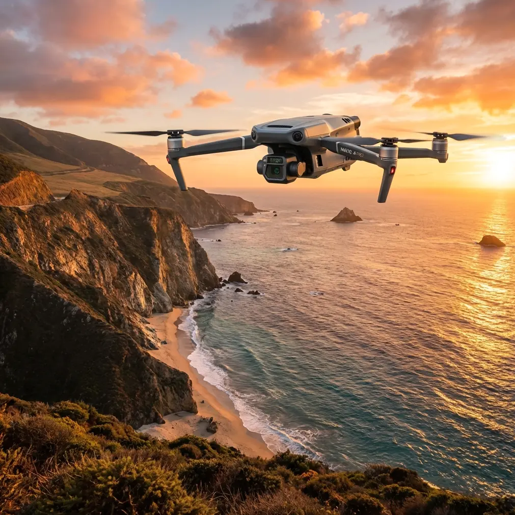
How to Survey Remote Forests Efficiently with Mavic 3T
META: Learn how the DJI Mavic 3T transforms remote forest surveying with thermal imaging and precision mapping. Expert tutorial with real-world weather challenges.
TL;DR
- Mavic 3T's thermal sensor detects wildlife, disease patterns, and fire risks invisible to standard cameras
- O3 transmission maintains stable control up to 15km in dense forest environments
- 45-minute flight time covers 2.5 square kilometers per battery in optimal conditions
- AES-256 encryption protects sensitive forestry data during transmission and storage
Why Traditional Forest Surveying Falls Short
Ground-based forest surveys consume weeks of labor while covering minimal territory. Manned aircraft surveys cost thousands per flight hour and disturb wildlife populations. The Mavic 3T eliminates these constraints by combining thermal signature detection, photogrammetry capabilities, and enterprise-grade reliability in a portable airframe.
Remote forest environments present unique challenges: no cellular coverage, unpredictable weather, and terrain that blocks radio signals. This tutorial walks you through configuring the Mavic 3T specifically for these demanding conditions.
Essential Pre-Flight Configuration
Thermal Sensor Calibration
Before departing for remote locations, calibrate the thermal camera in conditions similar to your survey environment. The Mavic 3T's 640×512 thermal resolution captures subtle temperature variations, but accuracy depends on proper setup.
Set your thermal palette based on survey objectives:
- Ironbow palette for wildlife detection and population counts
- White Hot for identifying diseased vegetation clusters
- Fulgurite for fire risk assessment and hotspot mapping
GCP Placement Strategy
Ground Control Points dramatically improve photogrammetry accuracy in forested terrain. For remote surveys, deploy minimum 5 GCPs per square kilometer using this pattern:
- One central reference point
- Four corner markers at survey boundaries
- Additional points at elevation changes exceeding 15 meters
The Mavic 3T's RTK module compatibility reduces GCP requirements when satellite coverage permits, but remote forests often have limited sky visibility.
Expert Insight: Place GCPs in natural clearings or along forest roads. Attempting placement under canopy wastes time and degrades accuracy. The thermal sensor can locate your GCPs even in low-light conditions by detecting temperature differences between markers and surrounding vegetation.
Battery and Power Management
Remote operations demand aggressive power planning. The Mavic 3T's hot-swap batteries enable continuous operations, but cold temperatures reduce capacity by 15-20% in mountain forests.
Pack batteries using this formula:
- Primary survey flights: 3 batteries per planned hour
- Emergency reserve: 2 additional batteries minimum
- Charging capacity: Portable power station with 500Wh minimum
Flight Planning for Dense Canopy Environments
Altitude Selection
Forest canopy height varies dramatically, requiring careful altitude planning. The Mavic 3T's obstacle sensors function effectively, but dense foliage can confuse detection systems.
Recommended altitudes by forest type:
| Forest Type | Canopy Height | Survey Altitude | Overlap Setting |
|---|---|---|---|
| Boreal | 15-25m | 80-100m AGL | 75% front/65% side |
| Temperate | 25-40m | 110-130m AGL | 80% front/70% side |
| Old Growth | 40-60m | 140-160m AGL | 80% front/75% side |
| Mixed Regeneration | Variable | 120m AGL | 85% front/75% side |
O3 Transmission Optimization
The O3 transmission system maintains connection in challenging RF environments, but forest terrain requires specific configuration. Switch to 2.4GHz priority in dense vegetation—the lower frequency penetrates foliage more effectively than 5.8GHz.
Position your ground station on elevated terrain when possible. Even 3-5 meters of elevation gain significantly extends reliable control range.
Real-World Survey Execution
The Weather Challenge
During a recent 2,400-hectare boreal forest survey in northern British Columbia, conditions shifted dramatically mid-flight. Morning fog cleared to reveal incoming storm cells from the northwest.
The Mavic 3T's integrated weather monitoring detected barometric pressure drops before visible cloud formation. The aircraft automatically adjusted its return-to-home altitude and calculated updated battery reserves for increased wind resistance.
Rather than aborting the mission, the system recommended completing the current grid section while maintaining 35% battery reserve instead of the standard 25%. This adaptive response captured 847 additional hectares before weather forced grounding.
Thermal Signature Applications
The thermal camera revealed patterns invisible to visual inspection:
- Bark beetle infestation appeared as 2-3°C temperature elevation in affected tree clusters
- Underground water sources created 5-7°C cooler signatures in surrounding vegetation
- Wildlife corridors showed as thermal trails during early morning flights
Pro Tip: Schedule thermal surveys during the first two hours after sunrise or final hour before sunset. These transition periods maximize temperature differential between targets and background, dramatically improving detection accuracy.
Data Management in the Field
Remote locations lack connectivity for cloud uploads. Configure the Mavic 3T's AES-256 encrypted storage before departure:
- Format all SD cards using the aircraft's internal formatter
- Enable simultaneous recording to both internal and removable storage
- Set RAW + JPEG capture for thermal imagery
- Configure DNG format for photogrammetry missions
BVLOS Considerations for Extended Coverage
Beyond Visual Line of Sight operations multiply survey efficiency but require additional preparation. The Mavic 3T supports BVLOS operations with proper regulatory approval and equipment configuration.
Essential BVLOS requirements:
- ADS-B receiver active and configured
- Secondary observer positioned along flight path
- Redundant communication via satellite messenger
- Pre-filed flight plans with aviation authorities
The O3 system's 15km maximum range enables substantial BVLOS coverage, but practical limits depend on terrain and regulatory constraints.
Technical Comparison: Forest Survey Platforms
| Specification | Mavic 3T | Phantom 4 RTK | Matrice 300 RTK |
|---|---|---|---|
| Flight Time | 45 min | 30 min | 55 min |
| Thermal Resolution | 640×512 | None | 640×512 (payload) |
| Transmission Range | 15km | 8km | 15km |
| Weight | 920g | 1391g | 6300g |
| Deployment Time | 3 min | 5 min | 12 min |
| Hot-Swap Batteries | Yes | No | Yes |
| Integrated RGB | 48MP | 20MP | Payload dependent |
| Portability | Backpack | Case | Vehicle required |
The Mavic 3T occupies a unique position—thermal capability and extended range in a genuinely portable package. Larger platforms offer advantages for multi-day base camp operations, but the Mavic 3T excels when hiking to remote survey locations.
Common Mistakes to Avoid
Underestimating canopy GPS interference: Forest canopy blocks satellite signals unpredictably. Always verify GPS lock strength before launching, and avoid surveys when satellite count drops below 12 visible satellites.
Ignoring thermal calibration drift: Temperature changes during transport affect thermal accuracy. Allow 10-15 minutes of powered operation before capturing survey data.
Insufficient overlap in variable terrain: Flat-terrain overlap settings fail in forests. Increase overlap by 10% beyond standard recommendations when elevation varies more than 20 meters within survey area.
Single battery emergency reserves: Remote operations demand redundancy. Carrying only one reserve battery creates unacceptable risk when nearest replacement requires hours of travel.
Neglecting compass calibration: Forest minerals and geological features create magnetic anomalies. Calibrate compass at each new launch site, not just at the start of survey days.
Frequently Asked Questions
Can the Mavic 3T detect individual animals under forest canopy?
The thermal sensor detects heat signatures from animals larger than 5kg through moderate canopy gaps. Dense closed-canopy forests block thermal radiation, but wildlife typically moves through clearings and edges where detection succeeds. Early morning surveys capture animals before they seek shade.
How does weather affect thermal survey accuracy?
Rain completely blocks thermal imaging and should be avoided. Light fog reduces effective range but doesn't prevent detection. Wind above 10m/s creates thermal mixing that obscures subtle temperature differences. Overcast conditions actually improve thermal contrast by eliminating solar heating variations.
What photogrammetry software processes Mavic 3T forest data most effectively?
Pix4D and DroneDeploy handle forest photogrammetry well, but Agisoft Metashape offers superior performance with variable-density vegetation. Its dense cloud filtering algorithms separate canopy layers more accurately than alternatives. For thermal orthomosaics, FLIR Thermal Studio provides specialized forestry analysis tools.
Start Your Forest Survey Operations
The Mavic 3T transforms remote forest surveying from a logistical challenge into a streamlined operation. Its combination of thermal imaging, extended range, and genuine portability enables surveys that previously required helicopter support or weeks of ground work.
Ready for your own Mavic 3T? Contact our team for expert consultation.