Mavic 3T: Master Urban Highway Surveying Efficiency
Mavic 3T: Master Urban Highway Surveying Efficiency
META: Learn how the DJI Mavic 3T transforms urban highway surveying with thermal imaging, RTK precision, and efficient workflows. Expert guide inside.
TL;DR
- Optimal flight altitude of 80-120 meters balances resolution quality with efficient coverage for urban highway corridors
- The Mavic 3T's 56× hybrid zoom enables safe inspection of infrastructure without entering restricted airspace
- Thermal signature detection identifies subsurface road defects invisible to standard RGB cameras
- O3 transmission maintains stable 15km video feed even in RF-congested urban environments
Urban highway surveying presents unique challenges that traditional methods simply cannot address efficiently. Traffic disruptions, safety hazards for ground crews, and the sheer scale of infrastructure demand a smarter approach.
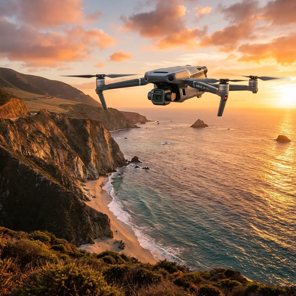
The DJI Mavic 3T combines a 48MP wide camera, 56× hybrid zoom telephoto, and a 640×512 thermal sensor in a compact airframe designed specifically for enterprise surveying operations. This guide breaks down exactly how to leverage each capability for highway corridor mapping, pavement analysis, and infrastructure assessment.
Why the Mavic 3T Excels in Urban Highway Environments
Urban corridors present a perfect storm of surveying complications. You're dealing with electromagnetic interference from power lines, restricted airspace near buildings, moving traffic, and the need for centimeter-level accuracy across kilometers of roadway.
The Mavic 3T addresses each challenge systematically.
Compact Form Factor for Congested Airspace
Unlike larger enterprise platforms, the Mavic 3T's 920g takeoff weight classifies it favorably under most aviation regulations. This matters enormously when surveying highways that pass near airports, helipads, or restricted zones common in urban areas.
The folded dimensions of 231×98×95mm allow rapid deployment from standard vehicles without blocking traffic lanes for equipment setup.
Triple-Sensor Payload for Comprehensive Data
Highway surveying isn't just about pretty pictures. You need actionable data across multiple spectrums:
- Wide camera (24mm equivalent): Captures broad context shots and photogrammetry datasets
- Telephoto (162mm equivalent): Inspects signage, joints, and structural details from safe distances
- Thermal sensor (40mm equivalent): Detects moisture intrusion, delamination, and subsurface voids
This combination eliminates the need for multiple flights with different payloads, cutting project time significantly.
Expert Insight: When surveying urban highways, I always capture thermal data during the early morning hours (5-7 AM) before solar loading begins. Pavement retains heat differently where subsurface moisture or voids exist, and this thermal signature becomes invisible once the sun heats the surface uniformly.
Optimal Flight Parameters for Highway Corridor Mapping
Getting your flight parameters right determines whether you'll produce survey-grade deliverables or unusable data. Here's what works based on extensive field testing.
Altitude Selection Strategy
The 80-120 meter altitude range represents the sweet spot for urban highway surveying. Here's why:
At 80 meters, the wide camera achieves approximately 2.1cm/pixel ground sample distance (GSD). This resolution captures pavement distress, lane markings, and drainage features with clarity suitable for condition assessments.
At 120 meters, you sacrifice some resolution (3.2cm/pixel GSD) but gain 47% more coverage per flight. For preliminary surveys or large-scale corridor mapping, this tradeoff makes sense.
Speed and Overlap Considerations
Maintain 8-10 m/s flight speed for photogrammetry missions. Faster speeds risk motion blur, while slower speeds waste battery life without improving data quality.
Configure your overlap settings based on deliverable requirements:
- Standard mapping: 70% front overlap, 65% side overlap
- High-accuracy photogrammetry: 80% front overlap, 75% side overlap
- 3D reconstruction: 85% front overlap, 80% side overlap
Pro Tip: Urban highways often feature repetitive textures (uniform asphalt, identical lane markings) that confuse photogrammetry software. Increase your overlap to 85%+ in these sections, or the software will struggle to find unique tie points between images.
Leveraging Thermal Imaging for Pavement Analysis
The Mavic 3T's thermal sensor transforms highway surveying from surface observation to subsurface investigation.
Detecting Hidden Pavement Defects
Thermal signature analysis reveals problems invisible to visual inspection:
- Moisture intrusion: Water-saturated base layers appear cooler than surrounding dry pavement
- Delamination: Air pockets between pavement layers create distinct thermal boundaries
- Void detection: Subsurface voids show temperature differentials during heating/cooling cycles
- Utility conflicts: Buried pipes and conduits often create linear thermal anomalies
Optimal Thermal Survey Timing
Thermal imaging effectiveness depends heavily on environmental conditions:
| Time Period | Thermal Contrast | Best Applications |
|---|---|---|
| Pre-dawn (4-6 AM) | High | Moisture detection, void identification |
| Morning (7-9 AM) | Moderate | General pavement assessment |
| Midday (11 AM-2 PM) | Low | Poor for pavement analysis |
| Evening (5-7 PM) | Moderate | Subsurface feature detection |
| Night (9 PM-12 AM) | High | Utility location, thermal mapping |
The 640×512 resolution thermal sensor provides sufficient detail for identifying defects down to approximately 15cm diameter from standard survey altitudes.
RTK Integration for Survey-Grade Accuracy
Highway engineering demands centimeter-level positioning. The Mavic 3T supports RTK connectivity through the DJI D-RTK 2 Mobile Station or network RTK services.
Setting Up Ground Control Points
Even with RTK, GCP placement improves absolute accuracy for engineering deliverables:
- Place GCPs at 500-meter intervals along corridor centerline
- Add GCPs at all horizontal and vertical curve points
- Position additional points at bridge approaches and major intersections
- Use high-contrast targets (black and white checkerboard pattern) visible in imagery
Achieving Photogrammetry Accuracy Standards
With proper RTK configuration and GCP placement, expect these accuracy levels:
- Horizontal accuracy: ±2-3cm
- Vertical accuracy: ±3-5cm
- Relative accuracy: ±1-2cm between adjacent points
These specifications meet requirements for preliminary engineering, quantity calculations, and as-built documentation.
Data Transmission and Security Considerations
Urban environments challenge drone communications with RF interference from cellular towers, Wi-Fi networks, and industrial equipment.
O3 Transmission Performance
The Mavic 3T's O3 transmission system maintains 1080p/30fps video at distances up to 15km in optimal conditions. More importantly for urban work, it handles interference gracefully through:
- Automatic frequency hopping across 2.4GHz and 5.8GHz bands
- Anti-interference algorithms that adapt to local RF conditions
- Redundant transmission paths that maintain control even when video degrades
Data Security Protocols
Highway infrastructure data often carries sensitivity requirements. The Mavic 3T implements:
- AES-256 encryption for all transmitted data
- Local data mode options that prevent cloud connectivity
- Secure SD card storage with optional encryption
For government highway projects, these security features often determine platform eligibility.
Mission Planning for Efficient Coverage
Surveying kilometers of highway corridor requires systematic mission planning to maximize productivity.
Battery Management Strategy
The Mavic 3T delivers approximately 45 minutes of flight time under ideal conditions. Real-world highway surveying typically achieves 35-38 minutes accounting for wind, temperature, and payload power consumption.
Hot-swap batteries enable continuous operations without returning to base. Carry a minimum of 4 batteries per 2km of corridor for comprehensive coverage with adequate safety margins.
BVLOS Considerations
Extended highway corridors often require beyond visual line of sight operations. While regulations vary by jurisdiction, the Mavic 3T's capabilities support BVLOS workflows:
- Reliable O3 transmission maintains command and control
- Automatic return-to-home triggers on signal loss
- ADS-B receiver (optional) provides manned aircraft awareness
Work with aviation authorities to obtain appropriate waivers before conducting BVLOS highway surveys.
Technical Comparison: Mavic 3T vs. Alternative Platforms
| Specification | Mavic 3T | Phantom 4 RTK | M300 RTK + H20T |
|---|---|---|---|
| Takeoff Weight | 920g | 1391g | 9000g+ |
| Flight Time | 45 min | 30 min | 55 min |
| Thermal Resolution | 640×512 | None | 640×512 |
| Zoom Capability | 56× hybrid | None | 23× hybrid |
| RTK Support | Yes | Yes | Yes |
| Deployment Time | <2 min | 5 min | 15 min |
| Transport | Backpack | Case | Vehicle |
The Mavic 3T occupies a unique position offering thermal capability and zoom performance in a portable package that larger platforms cannot match.
Common Mistakes to Avoid
Flying during peak traffic hours: Vehicle movement creates safety risks and may trigger obstacle avoidance systems unexpectedly. Schedule flights during low-traffic periods when possible.
Ignoring thermal calibration: The thermal sensor requires flat field calibration periodically. Uncalibrated sensors produce inconsistent temperature readings that compromise defect detection.
Insufficient overlap in uniform areas: Asphalt surfaces lack distinctive features. Photogrammetry software fails to align images without adequate overlap, creating gaps in your orthomosaic.
Neglecting airspace coordination: Urban highways often intersect controlled airspace. Failing to obtain proper authorizations risks enforcement action and project delays.
Single-pass thermal surveys: Thermal anomalies require verification. Always capture thermal data during at least two different time periods to confirm findings aren't artifacts of environmental conditions.
Frequently Asked Questions
What ground sample distance should I target for highway condition assessments?
For pavement distress identification meeting ASTM D6433 standards, target 2-3cm GSD using the wide camera. This resolution reliably captures cracking, rutting, and surface deterioration. Fly at 80-100 meters altitude to achieve this specification while maintaining efficient coverage rates.
Can the Mavic 3T thermal sensor detect underground utilities?
Indirectly, yes. Buried utilities often create thermal signature differences at the surface due to heat transfer or moisture migration along pipe trenches. Detection reliability depends on burial depth, soil conditions, and environmental timing. Thermal imaging supplements but doesn't replace traditional utility locating methods.
How do I handle highway surveying near airport approach paths?
Urban highways frequently pass through controlled airspace. Submit LAANC authorization requests through approved apps, coordinate with airport authorities for operations in Class B/C airspace, and maintain altitude restrictions specified in your authorization. The Mavic 3T's compact size and precise altitude hold simplify compliance with height restrictions.
The Mavic 3T represents a significant advancement in accessible enterprise surveying capability. Its combination of thermal imaging, precision positioning, and portable design makes it particularly well-suited for the demanding requirements of urban highway corridor work.
Ready for your own Mavic 3T? Contact our team for expert consultation.