Mavic 3T for Highway Surveys in Complex Terrain
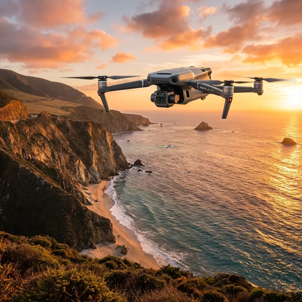
Mavic 3T for Highway Surveys in Complex Terrain: What Actually Matters in the Field
META: Practical guide to using the Mavic 3T for highway surveying in complex terrain, with thermal workflows, antenna positioning, transmission planning, and operational lessons tied to new Asia-Pacific drone survey momentum.
Highway surveying looks straightforward on a map. In the field, it rarely is.
Cut slopes block line of sight. Valleys swallow signal. Heat shimmer ruins confidence in long visual passes. One stretch of road can shift from open embankment to forested bend to concrete structure in minutes. That is exactly where the Mavic 3T becomes interesting—not because it is a generic “all-in-one” drone, but because its mix of thermal sensing, compact deployment, encrypted transmission, and efficient battery workflow fits the reality of corridor work better than many larger systems.
There is another reason this matters now. Asia-Pacific survey markets are clearly leaning harder into drone-enabled infrastructure work. A recent industry development makes that visible: Dronamics announced a strategic investment from Asia Air Survey Co., Ltd. (TSE: 9233) and is establishing Dronamics Japan Holdings Co., Ltd., with Asia Air Survey becoming its first Japanese investor through its corporate venture capital arm. That is not a Mavic 3T product update, but it is a useful signal. A specialist survey and geospatial player in Japan does not make moves like that by accident. It points to a broader operating environment where aerial data capture for infrastructure, logistics, and terrain-heavy projects is becoming more embedded in mainstream workflows.
For Mavic 3T operators surveying highways in complex terrain, that bigger market shift matters because expectations are changing. Clients are not just asking for imagery. They want rapid interpretation, repeatable capture, secure data handling, and operational resilience in awkward geography. The Mavic 3T can meet part of that demand if you fly it like a survey tool rather than a camera drone.
Start with the mission, not the aircraft
A highway survey in complex terrain is usually one of four jobs dressed up as one:
- Corridor condition review
- Slope and drainage assessment
- Thermal anomaly detection on adjacent assets or surfaces
- Progress documentation tied to mapping outputs
The Mavic 3T is especially useful when at least two of those need to happen in the same deployment. That is where its value becomes operational rather than theoretical. You can document visible surface conditions, identify thermal signatures that may point to drainage issues or heat-retaining material differences, and collect location-linked observations without dragging a larger aircraft and support package into difficult access zones.
That last point often gets overlooked. On a highway shoulder or mountain lay-by, setup time is not just about convenience. It affects traffic exposure, crew fatigue, and the number of safe launch options available before weather shifts.
Why thermal matters on highway work
Most teams still think of highway surveys as a purely visual or photogrammetry-first exercise. That leaves useful information on the table.
The Mavic 3T’s thermal capability can help isolate patterns that are easy to miss in RGB imagery alone. A thermal signature is not a diagnosis by itself, but it can flag areas worth closer engineering review. On corridor projects, that may include:
- Water movement or retention near pavement edges
- Variations across repaired surfaces
- Drainage structures behaving differently from surrounding material
- Heat contrast on retaining elements, culverts, or adjacent utilities
- Early-stage issues on slopes where moisture and material behavior diverge
In complex terrain, this becomes more valuable because visual interpretation is often compromised by angle, shadow, vegetation, or inaccessible ground position. Thermal does not replace standard survey practice, but it sharpens triage. You can identify which segments deserve boots-on-ground verification first, instead of treating every anomaly as equally urgent.
That is one of the strongest arguments for the Mavic 3T in this scenario. It is not trying to be the best pure mapping aircraft in every corridor mission. It is trying to help a field team see more, earlier, in places where a single revisit can cost half a day.
Photogrammetry on the Mavic 3T: use it carefully and deliberately
If your highway project depends on high-confidence measurement outputs, the Mavic 3T should be treated as part of a measured workflow, not a shortcut. Photogrammetry in complex terrain is unforgiving. Elevation changes, road camber, bridges, cuttings, and occlusions all reduce the quality of a lazy flight plan.
That means three practical rules.
1. Use GCPs where they materially improve confidence
Ground control points are not an administrative burden. In mountainous or broken terrain, they are often the difference between a useful corridor model and a dataset that looks convincing but drifts where it matters. Place GCPs at terrain transitions, not just at convenient flat spots. Highway bends, bridge approaches, crest changes, and slope interfaces are where errors hide.
2. Split the corridor into logical segments
A long road section flown as one continuous mission can create avoidable problems in overlap, exposure consistency, and terrain-relative altitude. Breaking the route into segments gives you cleaner control over flight geometry and reduces the risk of a single interruption affecting the entire dataset.
3. Treat terrain as a signal problem, not just an elevation problem
In complex terrain, your mapping plan and your transmission plan are linked. A route that looks efficient on-screen may push the aircraft behind ridgelines, concrete barriers, or vegetation masses that degrade control and live-feed awareness. Survey quality depends on stable execution. Stable execution depends on line of sight and antenna discipline.
Antenna positioning advice for maximum range
This is where many Mavic 3T operators underperform, especially in highway environments with steep sidewalls or rolling elevation.
The usual mistake is pointing the controller antennas directly at the aircraft as if they were laser pointers. That is not how you get the strongest link. For maximum range and consistency, you want the broad side of the antenna pattern facing the drone, not the antenna tips aimed at it. In practical terms:
- Keep the controller high on your body, not down at your waist.
- Rotate yourself as the aircraft moves so the antenna faces remain aligned to the flight path.
- If the drone is well above you on a slope, tilt the controller so the flat antenna faces still “present” toward the aircraft.
- Do not stand next to vehicles, guardrails, or dense metal objects if you can avoid it.
- On a winding road, reposition the pilot before the aircraft disappears behind terrain. Don’t wait for the signal to weaken.
O3 transmission is a major advantage here, but it is not magic. Complex terrain creates partial shielding and multipath reflections. That means signal quality can collapse faster than expected when the aircraft transitions behind a ridge shoulder or drops below your local horizon. The best operators fly with terrain awareness first and transmission confidence second.
A simple rule: if you would lose visual confidence in the next thirty seconds of flight because of the road geometry, your antenna setup and pilot position probably need to change now, not later.
Use battery workflow to preserve momentum
Hot-swap batteries are not just a convenience feature in survey work. They preserve mission rhythm.
Highway surveys often require repeated short flights rather than one long dramatic sortie. You launch, capture a section, land, verify data, shift location, launch again. Every delay compounds. If your battery process is sloppy, your coverage consistency drops and your crew starts making poor decisions late in the day.
For the Mavic 3T, that means building a disciplined cycle:
- Assign batteries to numbered route segments
- Log thermal and RGB mission purpose separately
- Check cell balance and temperature before relaunch
- Land with reserve appropriate to terrain complexity, not just nominal flight time
- Use natural pauses to review image completeness before moving vehicles
The value here is simple: fewer gaps, fewer rushed returns, fewer “we’ll fix it in the next pass” assumptions.
Secure data matters more than many field teams admit
Highway projects often involve sensitive infrastructure imagery, contractor progress documentation, and location-specific observations that should not be casually exposed. AES-256 transmission and secure handling practices matter because corridor data is not trivial. Even when the mission is entirely civilian and routine, the dataset may still be commercially sensitive.
For the Mavic 3T operator, that means security should be operationalized, not just mentioned in documentation:
- Standardize media handling at landing
- Control who receives raw thermal data
- Lock mission devices to approved accounts and workflows
- Separate field review copies from archive masters
- Keep transfer and storage procedures consistent across subcontract crews
That may sound administrative, but clients increasingly notice the difference between teams that collect data and teams that manage information professionally.
Where BVLOS fits—and where it doesn’t
The Mavic 3T is often discussed in the same breath as long-corridor ambitions, but highway work in complex terrain is exactly where BVLOS conversations need realism. Beyond visual line of sight operations can open clear productivity gains on infrastructure corridors, yet terrain complexity changes the risk picture fast. Ridgelines, tree cover, changing launch points, and mixed road geometry create a demanding environment for remote situational awareness.
So the practical takeaway is not “push longer.” It is “design legal, safe, terrain-aware segments that preserve observation and control.” In some regions and project structures, BVLOS may become more accessible as the industry matures. The move by Dronamics to establish Dronamics Japan Holdings Co., Ltd. and bring in Asia Air Survey as the first Japanese investor hints at that larger maturation process around aerial infrastructure operations in Asia. As serious aviation and geospatial players deepen their local structures, the whole ecosystem tends to become more operationally disciplined.
For a Mavic 3T crew today, the lesson is this: work like the market is growing up. Fly documented procedures. Build repeatable corridor methods. Show your client you understand airspace, terrain, and data integrity—not just image capture.
A practical field workflow for mountain or cut-slope highways
If I were deploying the Mavic 3T on a difficult highway section, I would structure the day like this:
Pre-site planning
Review terrain profiles, likely signal obstructions, and candidate launch points. Mark bends, overpasses, steep grade changes, and any section where the aircraft could drop behind local terrain from the pilot’s position.
Segment the route
Divide the corridor into short operational blocks. Each block should have a defined launch zone, observation goal, battery assignment, and expected imaging mode.
Capture visual baseline first
Run the RGB pass to establish broad condition context. This provides a clean reference layer before thermal interpretation introduces extra complexity.
Fly thermal where it adds value
Use thermal over drainage structures, slope interfaces, repaired pavement transitions, retaining features, and any area where moisture or material variation is suspected.
Validate overlap and geometry
If the mission supports photogrammetry outputs, confirm that the aircraft path, altitude consistency, and image coverage are strong enough before leaving the segment. Do not assume post-processing will rescue poor terrain-relative planning.
Reposition aggressively
Move the pilot location before the terrain forces the issue. Good antenna positioning and a cleaner line of sight are often worth more than squeezing a few extra minutes out of a launch point.
Tag anomalies immediately
When a thermal signature appears unusual, record it against a chainage or segment reference while still on site. Later interpretation is always faster when the field note is anchored to the visual context.
If your team wants to compare corridor planning approaches or field setups before a job, this direct project chat is a practical way to sort out mission details without burying the conversation in email.
What makes the Mavic 3T genuinely useful here
The strongest case for the Mavic 3T in complex highway terrain is not one headline feature. It is the way several features support each other under field pressure.
Thermal signature detection helps prioritize attention. O3 transmission supports more stable corridor execution when paired with smart pilot positioning. AES-256 aligns with professional handling of infrastructure data. Hot-swap battery discipline keeps a segmented route moving without unnecessary dead time. GCP-backed photogrammetry adds structure when visual documentation alone is not enough.
That is what separates a field-ready workflow from a brochure-level understanding of the aircraft.
And the wider market is moving in that direction. When a company such as Dronamics expands with a Japanese subsidiary and secures investment from Asia Air Survey, a listed geospatial and survey organization, it reinforces a larger truth: aerial infrastructure work is becoming more integrated, more local, and more operationally serious. Survey teams using compact platforms like the Mavic 3T should take that as a cue. The expectation is no longer just “collect drone footage.” The expectation is to produce dependable site intelligence under real terrain constraints.
For highway surveying, that is exactly where the Mavic 3T earns its place. Not as a universal answer, and not as a substitute for disciplined survey design, but as a compact aircraft that can see visible and thermal conditions quickly, move efficiently between hard-to-access positions, and support informed decisions where the road and the terrain refuse to make things easy.
Ready for your own Mavic 3T? Contact our team for expert consultation.