Surveying Wind-Exposed Power Lines with the Mavic 3T
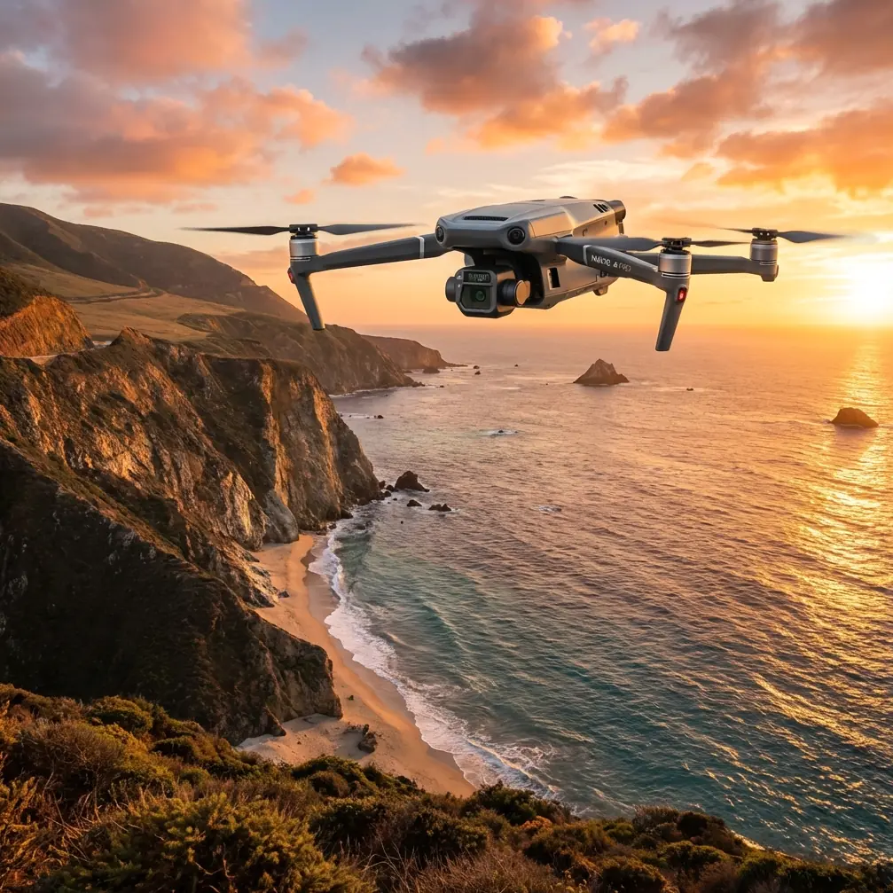
Surveying Wind-Exposed Power Lines with the Mavic 3T: A Field Case Study
META: A practical case study on using the DJI Mavic 3T for windy power line surveys, covering thermal checks, flight planning, transmission stability, georeferencing, and weather shifts mid-flight.
By Dr. Lisa Wang, Specialist
Power line inspections rarely happen in perfect weather. The terrain is uneven, access roads are rough, and the calm window you expected at 8 a.m. can disappear by 8:20. That is exactly why the Mavic 3T has become such a useful aircraft in utility work. It is not because it can do everything. It is because, in the hands of a disciplined pilot, it handles mixed inspection tasks without forcing a crew to split thermal assessment, visual review, and rapid documentation across multiple platforms.
This case study centers on a common utility scenario: surveying a medium-voltage line corridor in windy conditions, with the additional complication of a weather shift during the mission. The goal was straightforward on paper—inspect conductor attachments, identify abnormal heat patterns, confirm vegetation encroachment risk near structures, and produce a usable visual record for engineering follow-up. The challenge was that the site was exposed, the wind was unstable, and the team needed reliable data rather than a heroic flight.
Why the Mavic 3T fit this mission
The Mavic 3T occupies an unusual place in the inspection workflow. It is compact enough to deploy quickly from a roadside staging point, but it still carries a thermal payload alongside visual imaging. For power line work, that matters. A utility crew does not just need pretty imagery of towers and conductors. They need to detect thermal signature anomalies that may indicate stressed connectors, unbalanced loading effects visible at attachment points, or component heating that deserves a closer engineering review.
On this mission, the dual need was obvious from the start. The visual camera would support asset condition review and contextual documentation. The thermal sensor would help flag suspect hotspots before a technician was sent out. If all you have is RGB, you can document corrosion, tilt, damage, and vegetation. If all you have is thermal, you can miss the context around a heat event. Together, the payload mix changes the inspection from “recording what is visible” to “building a decision-ready picture.”
The second reason the Mavic 3T made sense was transmission confidence. On linear infrastructure, especially power lines, the aircraft often moves laterally across varied terrain rather than hovering over an open field. Signal integrity becomes more than a convenience. DJI’s O3 transmission system is not just a spec sheet detail here; it affects how comfortably and precisely the crew can maintain image review, framing, and obstacle awareness as the aircraft tracks along the corridor. In gusty conditions, stable downlink quality has operational value because the pilot and visual observer are making constant micro-decisions. Poor video means slower work and more conservative stand-off distances than the task may actually require.
The site and inspection objective
The route covered a stretch of distribution infrastructure crossing low hills and open ground. The wind profile was inconsistent. Surface-level conditions at launch looked manageable, but the ridgeline segments were clearly going to be rougher. That discrepancy is normal in utility inspection. It is also where planning errors creep in. Too many teams judge a mission by the feel of the launch zone rather than by the behavior of the corridor.
We divided the work into three layers:
- Initial visual pass to confirm route conditions and identify any obvious physical issues.
- Thermal pass focused on connectors, insulators, and termination-related heat signatures.
- Targeted documentation pass for any structures or spans requiring engineer review.
Because the reader scenario is surveying rather than purely thermographic troubleshooting, geospatial discipline also mattered. If you want imagery to support repeat inspections or engineering comparison, you need more than ad hoc screenshots. While the Mavic 3T is not a dedicated large-area photogrammetry platform in the same way some mapping-focused systems are, photogrammetry principles still matter when documenting utility assets. Consistent overlap, repeatable angles, and accurate location references improve the quality of downstream reporting. On sections where we needed stronger positional confidence, we referenced GCP-based control from prior corridor work to align observations against the utility’s existing spatial framework.
That point is often missed. GCP use is not limited to textbook mapping jobs. Even in an inspection-driven mission, tying observations back to known control improves traceability. For a utility asset manager, “there is a hotspot on a line somewhere near the eastern slope” is weak data. “The abnormal thermal signature is associated with a specific structure and conductor attachment previously tied to corridor control” is usable.
Launch conditions and the first phase
We launched in overcast morning light with moderate wind and occasional stronger gusts rolling across the line. The first leg was flown conservatively, not because the aircraft seemed under strain, but because power line surveys reward patience. You are not trying to finish quickly. You are trying to leave with evidence.
The Mavic 3T settled into the route well. Visual framing remained stable enough for structural review, and the O3 link stayed dependable through the first segment despite the terrain transitions. That stability changed the crew’s rhythm. Instead of fighting signal interruptions or guessing whether brief stutters were environmental or transmission-related, we could focus on inspection logic: where to pause, which components deserved angled review, and where thermal verification should follow visual suspicion.
The early thermal pass did exactly what it should do in utility work: not produce dramatic imagery, but quietly separate routine assets from questionable ones. One insulator-adjacent connection showed a warmer-than-expected pattern relative to neighboring points on the same alignment. This is where “thermal signature” must be handled carefully. A warm component is not automatically a failure. Load, sun angle, material properties, and environmental conditions all influence what you see. But relative variation within comparable assets is useful. The value of the Mavic 3T here is speed of triage. You can mark that asset for engineering review without escalating the whole corridor into a maintenance event.
When the weather changed mid-flight
Roughly halfway through the route, the weather shifted fast. The overcast thickened, wind speed increased along the ridge section, and the aircraft began dealing with more frequent lateral correction. This is the part of the mission that separates platform capability from operator discipline.
The wrong response in this moment is to press on because the drone is still technically airborne. The right response is to narrow the mission objective, tighten the flight envelope, and protect data quality. We abandoned the idea of a full corridor sweep in one run and switched to a priority-based approach: complete the structures with the highest maintenance interest, secure clean thermal and visual captures there, then return for a battery change and reassessment.
The Mavic 3T handled the change well, but “handled well” should not be romanticized. In gusting wind, no aircraft becomes immune to physics. What mattered was that it remained predictable. Predictability is what allows safe inspection decisions. The pilot could feel the aircraft compensating, but control response remained coherent and the live view stayed usable enough to continue targeted work rather than making a rushed retreat with incomplete observations.
This is also where battery management became central. In field inspection, hot-swap thinking is less about the literal chemistry and more about workflow. A compact aircraft only stays useful in utility operations if battery turnover is fast, organized, and planned around mission segmentation. When the wind picked up, our reserve policy mattered more than our total battery count. We landed earlier than originally planned, rotated packs efficiently, and relaunched only after deciding exactly which remaining structures justified the second sortie. That discipline preserves margin. It also reduces the temptation to overextend when weather starts rewriting the mission in real time.
Data security and utility workflow
One of the less glamorous but very real advantages in utility inspection is secure handling of flight data. Infrastructure operators are increasingly cautious about imagery, thermal records, and asset documentation moving through unsecured channels. AES-256 support is not a marketing footnote in this context. It matters because corridor imagery often contains sensitive infrastructure details, maintenance indicators, and location-linked records that should not be casually exposed.
For contractors or utility partners, this has practical implications. It is easier to fit the aircraft into an enterprise workflow when transmission and stored data protections align with internal security expectations. Inspection technology is not judged only by what it captures, but by how responsibly it fits into the operator’s data environment.
What the Mavic 3T did well on this job
Several strengths became clear during the mission.
1. Thermal and visual fusion in a single deployment
The Mavic 3T reduced field friction. Instead of sending one team for visual condition imagery and another for thermal follow-up, we were able to build a layered picture in one visit. For windy sites with limited access, that efficiency is not trivial. Every extra setup and launch cycle creates more exposure to changing weather and inconsistent light.
2. Transmission stability supported inspection quality
O3 transmission helped keep the mission deliberate. Power line surveys involve many “small corrections” moments—slight repositioning, angle changes, repeated looks at hardware, and cautious stand-off management. A dependable live feed supports those decisions.
3. It stayed useful after conditions deteriorated
The weather change did not end the mission immediately. It did force a more selective strategy, but the aircraft remained viable for priority tasks. In infrastructure inspection, that can be the difference between leaving with actionable findings and leaving with an expensive need to remobilize.
Where crews need realism
The Mavic 3T is not a substitute for a full utility aviation program, nor is it a magic answer for every corridor. If your objective is extensive linear mapping at scale, or if your operational framework points toward BVLOS concepts for long-distance infrastructure management, you are entering a different planning category involving regulatory, procedural, and platform considerations beyond this kind of close-range sectional survey.
For most civilian utility teams, though, the better question is not whether the aircraft can replace larger systems. It is whether it can solve the high-frequency inspection tasks that consume time and expose crews to unnecessary field effort. In that role, it performs well—especially when missions are designed around real environmental constraints rather than ideal ones.
Another realism point: photogrammetry around power lines is never just a software problem. Thin conductors, reflective surfaces, changing backgrounds, and wind-induced movement all challenge clean reconstruction. If the deliverable requires spatial reliability, good field discipline still matters: stable flight paths, repeatable geometry, and control references such as GCPs where appropriate. The drone helps, but method is what turns captures into defensible inspection records.
The operational takeaway
What stayed with me after this sortie was not a single dramatic image. It was the aircraft’s ability to preserve decision quality once the environment became less cooperative. That is the standard that matters in utility inspection.
The Mavic 3T gave us three things that day: rapid deployment, usable thermal insight, and stable enough control and transmission to keep the mission productive after the weather shifted. The hotspot candidate we flagged was later queued for ground verification. The visual record around several structures gave the engineering team enough context to prioritize maintenance review. And because the mission was flown with geospatial discipline, the findings were easier to connect back to the corridor’s existing documentation.
If you are building a workflow for power line surveys in windy areas, the lesson is simple. Do not evaluate the Mavic 3T only by camera specs or flight time tables. Evaluate it by how it behaves when a real corridor, real wind, and a changing sky begin to pressure your plan. That is when details like O3 transmission, AES-256 data handling, thermal signature interpretation, battery rotation strategy, and GCP-aware documentation stop being talking points and start becoming operational tools.
If you want to compare inspection workflows or discuss how teams are structuring similar utility missions, you can message our field desk here.
Ready for your own Mavic 3T? Contact our team for expert consultation.