Surveying Venues in Extreme Temperatures with the Mavic 3T
Surveying Venues in Extreme Temperatures with the Mavic 3T: What Actually Matters in the Field
META: A technical review of using the DJI Mavic 3T for venue surveying in extreme heat and cold, with practical guidance on thermal signatures, pre-flight cleaning, O3 transmission, AES-256 security, photogrammetry limits, and battery planning.
When people talk about the Mavic 3T, they often jump straight to the thermal camera. That makes sense. Thermal is the headline feature. But if your job is surveying venues in extreme temperatures, the aircraft’s value has less to do with one sensor in isolation and more to do with how the platform behaves as a system when conditions are working against you.
That distinction matters at stadiums, outdoor event grounds, racetracks, campuses, industrial venues, and temporary structures set up in harsh climates. Extreme cold changes battery behavior. Extreme heat introduces shimmer, glare, and thermal clutter. Wind funnels between grandstands and service buildings. Dust and condensation can interfere with obstacle sensing and image quality at the exact moment you need repeatable data.
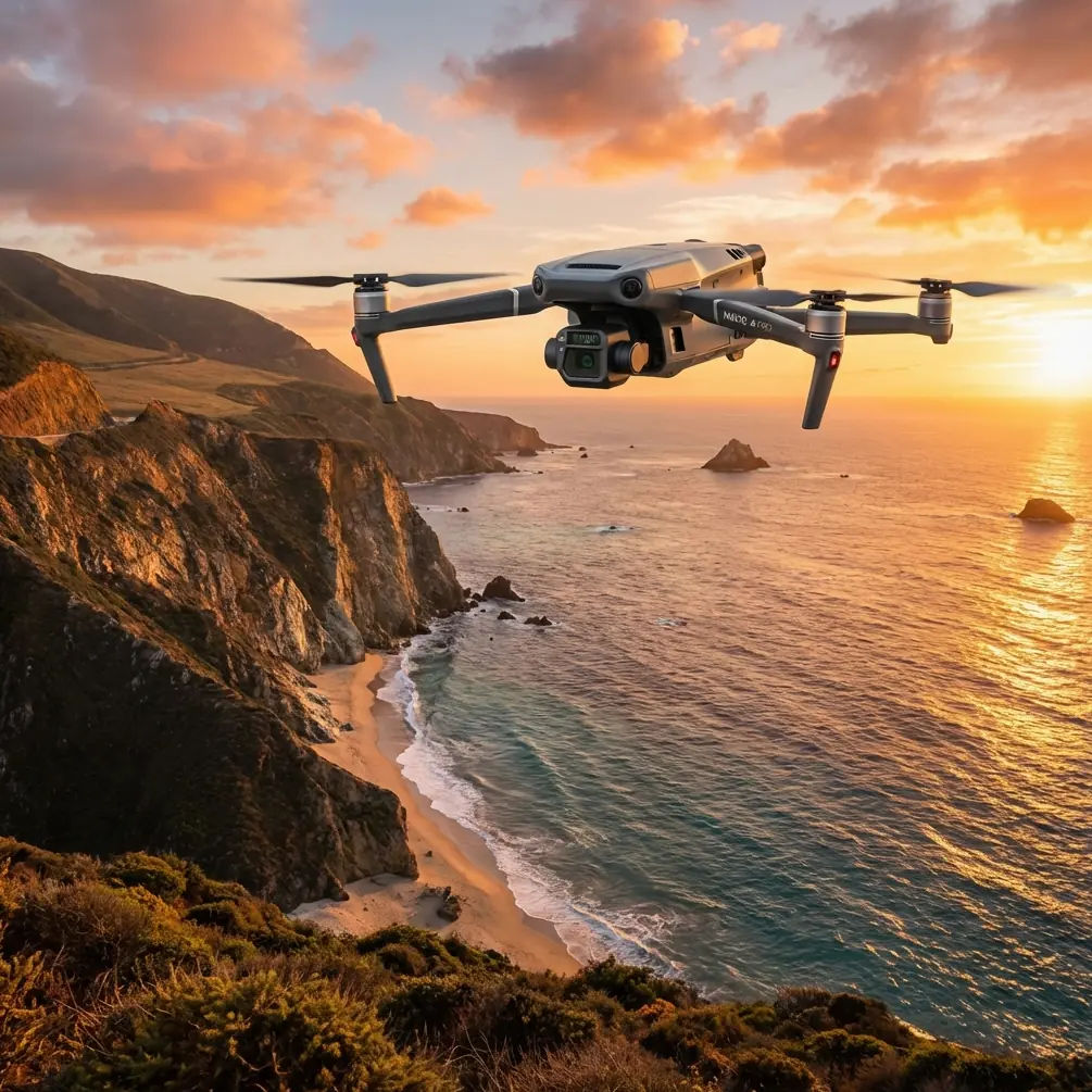
The Mavic 3T is compelling in this context because it combines a thermal sensor with a wide camera, a tele camera, long-range O3 transmission, and AES-256 encrypted transmission into a compact airframe that can be deployed quickly. On paper, that sounds tidy. In practice, it means one aircraft can support visual documentation, thermal analysis, perimeter review, roof inspection, and situational assessment without forcing the pilot to switch platforms mid-job.
Why venue surveying in extreme temperatures is a different discipline
A venue is not a blank field. It is a layered environment. Roof membranes absorb heat differently than seating sections. HVAC exhaust creates localized thermal noise. Asphalt staging areas may still radiate heat after sunset. In cold weather, snowmelt around utility lines can show up as an anomaly long before the issue is visible in RGB imagery.
That is where thermal signature interpretation starts to separate experienced operators from casual users. The Mavic 3T can reveal temperature differentials, but a venue surveyor still has to understand what those differentials mean. A hot patch on a roof may indicate trapped moisture under membrane layers, a mechanical unit running harder than expected, or simply solar loading from a darker material. The camera gives you a clue. The operator provides the judgment.
For venue work, this is especially useful during pre-event inspections. You may need to identify uneven heat on electrical cabinets, drainage patterns on roofing, or cold spots in enclosed areas where insulation has failed. Those findings are more useful when they are paired with georeferenced visual context. The Mavic 3T is strong here because the thermal view is not isolated from the rest of the inspection workflow.
The cleaning step too many pilots skip
Before any extreme-temperature mission, I care about one pre-flight habit more than most checklists emphasize: cleaning the safety-critical optical surfaces.
That means wiping the vision sensors, checking the thermal lens window, cleaning the RGB lens, and making sure there is no moisture film, dust, salt residue, or fine grit on the aircraft’s sensing surfaces. It sounds minor until you fly in environments where temperature swings create condensation or where dry wind pushes abrasive particles into every seam.
Operationally, this matters for two reasons.
First, obstacle sensing performance depends on clean sensor surfaces. In venue environments full of poles, rigging, cables, roof edges, lighting arrays, and facade details, degraded sensing is not a small issue. Even if you fly conservatively, dirty sensors can affect confidence in close-in maneuvering around structures.
Second, thermal interpretation can be compromised by something as simple as contamination on the lens window. If you are trying to compare a suspected hotspot across multiple passes, you do not want haze or residue altering contrast and clarity. In heat, this can be subtle. In cold, condensation can be obvious but still easy to underestimate once the aircraft is airborne.
A clean aircraft is not cosmetic preparation. It is data hygiene.
Thermal is powerful, but venue surveys still need visual structure
One mistake I see in Mavic 3T discussions is treating thermal as a replacement for disciplined survey practice. It is not.
If the task involves photogrammetry, measurement consistency, or repeatable documentation, you still need a method. Ground control points, or GCPs, remain relevant whenever you need tighter positional confidence than onboard navigation alone can provide. That is true even if the final output is being used alongside thermal observations rather than as a pure mapping deliverable.
For example, imagine a large outdoor entertainment venue with multiple temporary structures and utility runs. Thermal can help identify unusual heat loss or electrical load patterns, but if the operations team wants a reliable base map to compare conditions over time, your capture strategy needs overlap, geometry, and control. The Mavic 3T can support that broader workflow, but it does not exempt the pilot from survey fundamentals.
This is where expectations need to be managed. The aircraft is excellent for rapid field intelligence and mixed-sensor inspection. It is not a magic shortcut past photogrammetric discipline. If your client needs centimeter-grade repeatability across changing site layouts, GCP planning is still part of the conversation.
O3 transmission is more than a range spec
For venue work, O3 transmission is often discussed as a headline number. That misses the practical benefit.
The real value is signal stability and image quality when working around complex site geometry. Large venues are notorious for creating line-of-sight complications. Steel structures, service tunnels, concrete cores, temporary broadcast equipment, and dense RF environments can all make a simple mission less simple. A robust transmission system gives the pilot cleaner live feedback, which supports better framing, safer routing, and faster decision-making when conditions are shifting.
That matters even more in extreme temperatures because you are often trying to minimize time on station. In severe cold, you want efficient sorties with no wasted hovering. In high heat, you want to get the necessary passes without unnecessary exposure of aircraft and batteries to thermal stress. Stable transmission helps reduce indecision and repeat work.
If your organization is building procedures for larger properties and future BVLOS planning is part of the strategic roadmap, understanding link reliability becomes even more relevant. Not because the Mavic 3T turns every venue survey into a BVLOS operation, but because disciplined communication-link management starts long before a company expands operational scope.
AES-256 is not just a compliance box
Venue surveying increasingly involves sensitive sites: private campuses, utility-connected infrastructure, major event properties, and facilities that do not want raw aerial footage circulating loosely across networks and devices.
The Mavic 3T’s AES-256 encrypted transmission matters here because operational security is part of professional survey practice. This is not only about protecting thermal imagery. Visual data can reveal access points, rooftop equipment layouts, service routes, and temporary event infrastructure. Even routine inspection footage can have confidentiality value.
From a workflow standpoint, secure transmission helps organizations justify drone use in environments where internal IT or facilities teams may be cautious. It is one thing to say the drone can collect useful data. It is another to explain that the transmission path itself is designed with strong encryption. That changes the internal conversation.
For teams that need to discuss secure deployment options before rolling out a venue inspection program, a quick technical chat can save time; use this direct WhatsApp line for operational questions: https://wa.me/85255379740
Battery management in heat and cold: where missions are won or lost
Venue surveys often fail quietly at the battery-planning stage. Not in a dramatic way. More often through conservative choices made too late because the aircraft is already on site and conditions are not matching the forecast.
In cold weather, battery performance and available flight time can drop in ways that disrupt carefully planned capture grids. In hot weather, long idle times on sunlit pavement can push pack temperatures into less comfortable territory before takeoff. Either way, the pilot ends up compressing the mission.
This is why people searching for “hot-swap batteries” in relation to the Mavic 3T are really asking a bigger operational question: how quickly can I keep the survey moving without degrading data quality? The answer is not just carrying more batteries. It is staging them properly, protecting them from ambient extremes, rotating them intelligently, and sequencing sorties so the highest-priority capture happens first.
At venues, that usually means collecting critical roof, facade, and utility-area data before lower-priority perimeter imagery. If temperature or wind starts reducing endurance, you have already secured the decision-grade material.
A compact aircraft like the Mavic 3T helps because deployment is fast and crew burden is relatively low. That is a real advantage when conditions force short operational windows. But compact does not mean casual. Battery discipline is still mission discipline.
Using thermal signatures the right way on venues
The Mavic 3T’s thermal capability is most effective when you stop asking it to “find problems” and instead ask it to test specific assumptions.
Is a rooftop mechanical area running hotter than surrounding equipment? Are drainage pathways behaving differently after temperature swings? Is one section of exterior envelope losing heat unevenly? Are electrical enclosures showing suspicious contrast relative to adjacent units?
Those are good thermal questions. They are anchored to building behavior.
At venues, false positives are everywhere. Sunlit surfaces can mimic concern. Reflections can distort interpretation. High-emissivity and low-emissivity materials do not present the same way. Temporary structures can cool or heat faster than permanent ones, creating patterns that look meaningful until you correlate them with material type and exposure.
This is where the Mavic 3T’s mixed-sensor workflow becomes useful. You are not relying on thermal alone. You can compare thermal observations against wide-angle visual context and, when needed, tighter tele views to validate what you are seeing before you send anyone onto a roof or into a restricted service area.
That saves time, but more importantly, it reduces misdiagnosis.
Where the Mavic 3T fits in a technical review
For surveying venues in extreme temperatures, the Mavic 3T is best understood as a fast-response inspection and documentation aircraft with unusually strong thermal utility for its size.
Its strengths are clear:
- It can be deployed quickly in changing weather windows.
- It gives operators thermal and visual perspectives in one platform.
- O3 transmission supports more confident work around large, interference-prone sites.
- AES-256 encrypted transmission is relevant for organizations handling sensitive infrastructure imagery.
- It adapts well to inspection-driven missions where the output is not just a map, but a combination of findings, images, and location-aware observations.
Its limitations are equally worth respecting:
- Thermal interpretation still requires experience.
- Photogrammetry standards do not disappear because the aircraft has thermal capability.
- Extreme temperatures expose weak battery planning fast.
- Dirty sensors and lenses can undermine both safety and data quality before the mission even starts.
If I were writing a field SOP for venue teams using the Mavic 3T, the opening lines would not be about fancy features. They would be about basics done correctly: clean the sensing surfaces, verify lens clarity, confirm battery temperature strategy, define what thermal anomaly you are actually looking for, and decide where GCP-supported documentation is necessary.
That is how this aircraft earns its place. Not as a gadget with a thermal feed, but as a serious tool for disciplined operators who need useful answers under difficult environmental conditions.
The Mavic 3T is at its best when the mission is messy: mixed materials, unstable temperatures, limited access, tight timelines, and a client who needs more than pretty aerial footage. In that setting, the aircraft’s combination of thermal signature analysis, visual confirmation, secure transmission, and efficient deployment starts to make real operational sense.
Ready for your own Mavic 3T? Contact our team for expert consultation.