Mavic 3T in a Vineyard Heat Swing: A Field Case Study
Mavic 3T in a Vineyard Heat Swing: A Field Case Study from Dr. Lisa Wang
META: A real-world Mavic 3T vineyard case study covering thermal signature shifts, photogrammetry workflow, GCP strategy, O3 transmission stability, AES-256 security, and flight decisions during extreme temperature changes.
By Dr. Lisa Wang, UAV Systems Specialist
Vineyard surveys look gentle from the road. In the air, they are not.
Rows repeat for hundreds of meters, terrain rolls just enough to upset altitude consistency, and temperature behaves like a second landscape layered on top of the first. In one recent Mavic 3T mission, our target was not simply to map vines. We needed to understand stress patterns across blocks during an extreme-temperature day, while preserving enough visual consistency for photogrammetry and enough thermal fidelity to support irrigation and canopy management decisions.
That distinction matters. Plenty of operators can bring back attractive orthomosaics. Fewer can explain why a dataset remains trustworthy after the weather changes in the middle of the flight.
This case study focuses on that problem.
The mission brief: thermal stress and mapping in the same sortie
The site was a commercial vineyard dealing with uneven vine vigor across several parcels. The manager wanted two outputs:
- a spatially reliable map for comparing row condition across blocks, and
- a thermal layer showing where canopy temperatures diverged enough to justify a ground inspection.
The day started cold at launch. By the second battery cycle, direct sun had intensified, wind shifted across the rows, and the temperature profile of the leaves changed faster than the team expected. That is exactly where a Mavic 3T becomes interesting. Not because it is a miracle machine, but because it allows a disciplined operator to hold together several sensing and operational threads at once: visible imagery, thermal signature interpretation, secure transmission, and stable mission execution under changing field conditions.
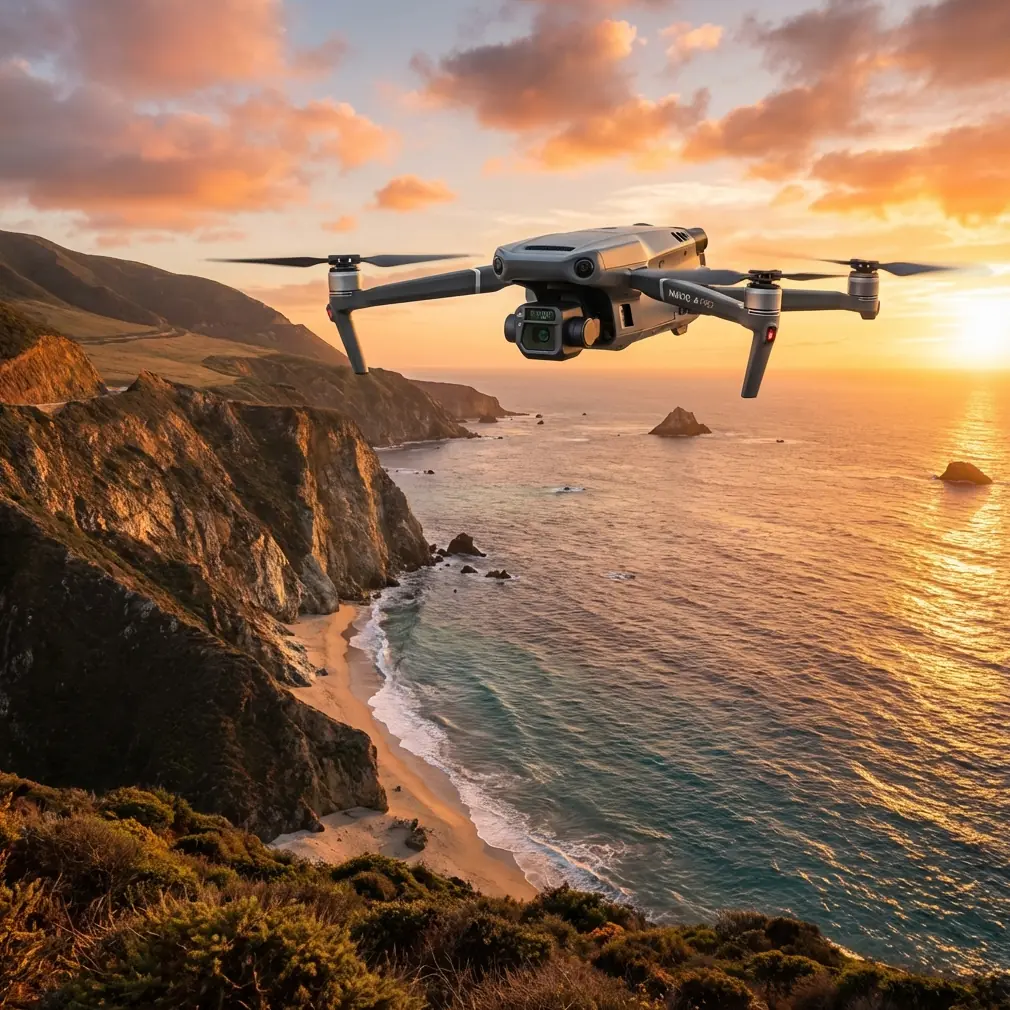
Why the Mavic 3T fit this vineyard job
For vineyard work in difficult temperatures, the useful question is not “can the drone fly?” It is “can the drone produce interpretable data when conditions stop being uniform?”
The Mavic 3T gives you a practical answer because it combines thermal sensing with a mapping-capable visual workflow in a compact airframe. In vineyards, that compactness is not a side note. You often launch from narrow access lanes, reposition frequently, and work around labor activity, trellis systems, and terrain breaks. A larger platform can offer advantages, but it also raises deployment friction. On this mission, speed of setup helped us react before the temperature window moved too far.
The other advantage was transmission resilience. In agricultural terrain, you may not have city-style radio clutter, but long rows, small elevation changes, and changing aircraft orientation can still expose weak links in command and video. O3 transmission gave us the consistency needed to keep thermal review live while the aircraft moved across multiple blocks. That reduced the risk of discovering a framing or overlap problem only after landing.
Planning around thermal truth, not just coverage
A vineyard operator usually thinks in blocks, row direction, water zones, and harvest decisions. A drone operator should think in timing, overlap, sun angle, and calibration discipline. To make the Mavic 3T outputs useful, those mental models have to meet.
We started with a photogrammetry plan built around visible imagery, then adjusted the sortie timing to preserve thermal meaning. Thermal data in vineyards is seductive because hot areas stand out. But “stands out” is not the same as “actionable.” A row edge can heat differently from an interior row. Sunlit leaves can bias interpretation. Soil exposure between vines can dominate a thermal scene if the angle is wrong.
So we broke the work into phases:
- first pass for cooler baseline conditions,
- second pass as ambient temperature climbed,
- targeted thermal review of suspect blocks rather than trying to thermal-map every hectare in a single unbroken assumption set.
That mid-mission segmentation made the final analysis much cleaner.
The weather shift that changed the flight
The turning point came halfway through the operation. Early data suggested one western block had a consistent cooler canopy corridor, possibly from stronger moisture retention. Then sunlight intensified and the breeze rotated. Surface response changed fast. The thermal contrast that had looked uniform began to fragment.
This is where less experienced teams often make a costly mistake: they keep flying the original plan as if nothing happened.
We did the opposite. We paused, reviewed the live thermal signature trends, checked image consistency, and modified the route. The Mavic 3T handled the change well because the aircraft remained easy to reposition and relaunch without turning the mission into a logistical event. That sounds mundane. It is not. In agricultural operations, the easiest platform to adapt is often the one that captures the most usable dataset by the end of the day.
The practical takeaway was simple: the thermal layer had to be treated as time-sensitive evidence, not as a static overlay.
GCPs still mattered, even with a smart workflow
A lot of vineyard managers ask whether ground control points are still worth the trouble on a compact platform. For this mission, yes.
We placed GCPs to strengthen spatial confidence across rolling terrain and to improve block-to-block comparison in the visible map products. In vineyards, rows create visual repetition that can mask subtle alignment errors. If your orthomosaic drifts even slightly, a temperature anomaly can appear to sit on the wrong row segment or irrigation lane. That is a management problem, not just a cartography problem.
With GCP support, we could tie areas of concern back to specific vine rows with less ambiguity. For a grower trying to verify irrigation emitter performance or investigate canopy stress, that positional confidence is worth more than a superficially neat map.
Thermal interpretation in vineyards: what mattered on this flight
The most useful thermal insight was not the hottest patch. It was the difference between persistent warm canopy response and transient heating caused by changing sun exposure.
The Mavic 3T helped us isolate three categories:
- Consistent warm rows that stayed elevated relative to neighboring rows through the weather shift
- Edge effects where thermal readings changed quickly with sun angle and airflow
- Ground-driven artifacts where exposed soil influenced the scene more than the vines themselves
That distinction prevented a false alarm in one block. At first glance, a band of higher temperature looked like irrigation underperformance. After comparing the earlier pass and the later pass, the pattern lined up more with exposure and canopy geometry than with sustained vine stress. Without that second review, the vineyard team might have spent labor hours chasing the wrong issue.
This is one reason I resist generic advice about thermal agriculture. The sensor does not create agronomic truth by itself. It reveals patterns, and the operator has to protect the meaning of those patterns.
A design lesson from aircraft engineering that applies in the field
Two reference points from classic aircraft design are surprisingly relevant here.
The first comes from structural design logic: when geometry and loading are fixed, higher section efficiency and higher specific stiffness can reduce weight. One example in the source material is especially striking: when the tube ratio d/D reaches 0.9, a hollow member can weigh only about one-third as much as a solid one, though local buckling risk increases if walls become too thin. In aircraft structures, that tradeoff is about keeping mass low without sacrificing stability.
Why does that matter to a vineyard drone mission? Because every field operator benefits from the same engineering principle in the finished aircraft. Lightweight efficiency is not just a brochure virtue. It supports manageable deployment, predictable handling, and productive battery use when temperatures swing. In vineyard work, where flights are often repeated block after block, structural efficiency upstream translates into operational efficiency downstream.
The second reference point comes from avionics bus design. One handbook section describes how a fiber-based MIL-STD-1773 bus keeps the same communication protocol, throughput structure, terminal definitions, and bus length behavior as 1553B, while allowing new functions to be added without disrupting existing equipment. It also notes that an enhanced 1773 bus can replace 4 to 5 separate 1553 buses. Another relevant detail is the appeal of a passive central star coupler topology for broadcast communication and system monitoring.
That sounds far removed from a vineyard. It is not. The operational significance is interoperability and dependable data flow. In modern UAV fieldwork, we ask compact aircraft to do more than capture images. We expect synchronized sensing, stable communications, clean system monitoring, and secure transfer habits. The fact that aviation solved these integration problems through standardized, scalable data architectures explains why today’s better UAV workflows feel coherent instead of fragile.
You can see the same philosophy in practice when a Mavic 3T maintains steady live situational awareness while juggling imaging tasks under variable conditions.
O3 transmission and AES-256 in real agricultural operations
In this mission, O3 transmission was not a marketing feature. It was the reason we could make an informed decision during the weather break.
Live review let us compare row response while still in the air, rather than waiting until processing to discover that conditions had shifted the thermal story. That shortened the loop between observation and action.
AES-256 also deserves more respect in commercial agriculture than it usually gets. Vineyard maps are not trivial files. They can reveal block health, infrastructure layout, management timing, and operational priorities. When growers share data with consultants, irrigation specialists, or remote agronomy teams, security stops being abstract.
We kept the workflow disciplined: controlled file handling, documented mission segmentation, and secure sharing only to the people evaluating the results. If you manage distributed teams and want to compare field observations quickly, a simple direct coordination channel can save time; in this project we used a private messaging handoff for same-day review at this vineyard survey contact line.
Hot-swap thinking, even when the platform itself is compact
Strictly speaking, vineyard operators often use “hot-swap batteries” loosely to mean rapid battery turnover with minimal downtime. That mindset shaped this mission.
Because temperatures were moving, every minute on the ground mattered. We staged batteries, pre-labeled sortie objectives, and assigned one team member to update field notes while another prepared the next launch sequence. The result was continuity. We did not lose the thermal window between flights.
This is one of the hidden strengths of the Mavic 3T for commercial agriculture. The aircraft is small enough that the entire sortie rhythm can stay tight. In practice, that often matters more than theoretical endurance numbers discussed in isolation.
What about BVLOS?
For this vineyard assignment, operations remained within the applicable visual framework. Still, the job raised the question many larger agricultural operators ask: can this sort of workflow scale toward BVLOS-style coverage planning in the future?
From a systems perspective, the answer depends less on the drone alone and more on the total operational environment: regulation, risk management, communication integrity, site procedures, and data handling. The Mavic 3T is very effective for structured block inspections and targeted thermal scouting. For large estates, it can also serve as a decision tool that identifies where deeper follow-up should occur, whether by ground crew or a larger mapping platform.
That division of labor is often smarter than forcing one aircraft into every role.
What the vineyard team learned
By the end of processing, the most useful output was not a single dramatic thermal screenshot. It was a layered interpretation:
- a visible map tied back to GCP-supported spatial references,
- a time-aware thermal comparison that separated persistent stress from weather-driven fluctuation,
- a shortlist of rows for on-foot verification.
Two blocks were prioritized for irrigation system checks. One block that initially looked problematic was downgraded after the second pass showed the pattern was largely environmental. That saved the grower from misallocating labor.
This is the kind of result that makes a Mavic 3T worth discussing seriously. Not because it replaces agronomy. Because it improves the timing and precision of agronomic decisions when the field is changing faster than a human can walk it.
Final assessment
If you are surveying vineyards in extreme temperatures, the Mavic 3T performs best when you stop treating it as a simple flying camera. It is a short-cycle sensing platform. Its value comes from combining thermal signature awareness, photogrammetry discipline, transmission confidence, and adaptable field procedure.
The engineering logic behind efficient airframes and robust data architectures is not just academic history. It shows up every time a compact drone stays useful after conditions stop behaving.
That was the real story of this mission. The weather changed mid-flight. The vineyard changed with it. The Mavic 3T gave us enough stability, visibility, and speed to recognize the difference.
Ready for your own Mavic 3T? Contact our team for expert consultation.