Mavic 3T for High-Altitude Wildlife Surveying
Mavic 3T for High-Altitude Wildlife Surveying: What Actually Matters in the Field
META: A specialist field guide to using the DJI Mavic 3T for high-altitude wildlife surveys, with practical insight on thermal detection, transmission reliability, mapping limits, and mission planning.
High-altitude wildlife surveying punishes weak aircraft. Thin air steals lift. Wind changes direction without warning. Cold temperatures hit battery performance fast, and the terrain itself creates blind spots that can turn a simple count mission into a data-quality problem. If the goal is to detect animals accurately, document movement, and return with usable imagery instead of partial observations, platform choice stops being a spec-sheet debate and becomes an operational decision.
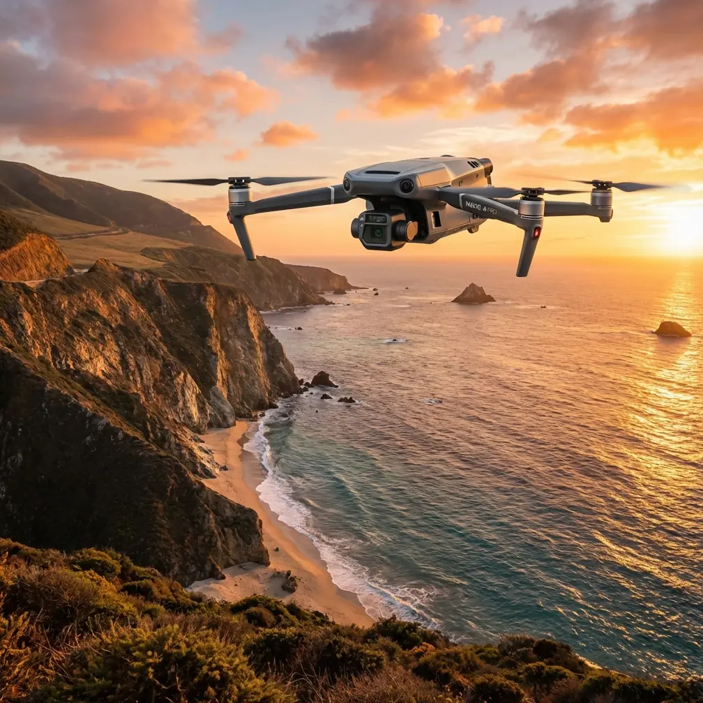
That is where the DJI Mavic 3T stands out.
I say that as someone who looks at aircraft through the lens of field outcomes, not brochure language. For wildlife teams working in alpine zones, plateau environments, and rugged ridgelines, the Mavic 3T solves a very specific challenge: it combines rapid deployment, a thermal sensor for heat-based detection, a visible-light camera for verification, and a flight system compact enough to be carried to sites that larger enterprise aircraft make unnecessarily burdensome. In high altitude, those traits matter more than raw size.
The problem is simple to describe. Spotting wildlife in mountainous or elevated terrain is rarely just about seeing an animal. It is about distinguishing a valid thermal signature from sun-warmed rock, confirming species or group size with daylight imagery, and doing it before weather or battery margins narrow. Ground teams often lose time traversing slopes that could have been screened from the air in minutes. Traditional visual-only drones can help, but once animals blend into scrub, shadow, or snow-edge terrain, visible imagery alone starts missing what the eye on a monitor cannot separate cleanly.
The Mavic 3T addresses that problem by pairing thermal imaging with a 48 MP wide camera in a small folding airframe. That combination has real operational significance. The thermal side helps detect animals hidden by low vegetation, uneven light, or dawn and dusk conditions. The high-resolution visible camera then gives the team a way to verify context, position, and terrain relationships. In wildlife work, that second step is crucial. Thermal detection finds a heat source; visible imaging helps interpret what that source is and whether the observation belongs in your count dataset.
Compared with many competing compact drones, the Mavic 3T’s edge is not simply that it includes thermal. It is that the aircraft integrates thermal and visual workflows without forcing survey teams into a heavier, slower deployment model. A larger platform may carry more payload or promise longer endurance on paper, but that advantage can disappear in high-altitude operations where access is difficult and launch windows are short. If a crew can hike a Mavic 3T to a ridge, launch quickly, scan a basin, relocate, and repeat, that mobility often produces better survey coverage than a bulkier system left closer to the road.
Transmission reliability is another reason this model earns attention. DJI’s O3 transmission system is not just a convenience feature for pilot comfort. In mountainous terrain, maintaining a stable live view can directly affect data capture quality and safety margins. Ridgelines, tree bands, and broken topography regularly interfere with line-of-sight. A stronger digital link helps the pilot preserve situational awareness during oblique scanning passes or while repositioning over valleys where terrain can distort signal behavior. In practical terms, fewer interruptions in the feed mean fewer rushed decisions and more disciplined target confirmation.
Security also matters more than many wildlife teams initially expect. Conservation surveys, anti-poaching patrol support, and species monitoring can involve sensitive location data. Nest sites, migration staging areas, and concentrations of rare animals should not circulate casually. The Mavic 3T’s use of AES-256 encryption is therefore not a side note. It strengthens the handling of transmitted data and mission information in a way that fits conservation operations where location exposure can carry real ecological consequences. For field programs working with government agencies or protected-area authorities, that can support better compliance and better trust.
Still, no aircraft fixes poor survey design. High altitude introduces three persistent problems that operators need to manage even with a capable system.
The first is thermal ambiguity. A thermal signature is not always an animal. Rocks that absorbed heat during the day, exposed ground patches, and man-made debris can all create false positives. With the Mavic 3T, the best practice is to treat thermal as the detection layer and visual zoom or wide imagery as the interpretation layer. This is where the drone’s integrated payload approach becomes efficient. You detect with heat, verify with optics, then log the observation with enough context for later review. Teams using separate workflows often lose time during that transition.
The second problem is altitude-related battery management. Cold air and elevation reduce margin. Even when the Mavic 3T performs well, prudent operators should plan shorter sectors than they would at lower elevations and preserve reserve power for wind-driven returns. This is where hot-swap batteries become part of mission rhythm rather than a nice extra. Wildlife windows can be narrow, especially near dawn when thermal contrast is strongest. The ability to cycle packs efficiently and relaunch quickly lets crews keep pressure on that window instead of watching it close during a long reset. In the field, tempo matters.
The third problem is turning sightings into survey-grade records. Many wildlife teams now want more than anecdotal observations; they need repeatable spatial products. This is where users must understand the Mavic 3T’s strengths and limits around photogrammetry. The aircraft can support mapping-oriented work through its visible camera, but thermal wildlife detection and photogrammetric accuracy are not the same task. If the objective is habitat mapping, trail analysis, or documenting animal-use corridors, visible imagery can contribute to useful orthomosaics. If the objective is precision measurement, GCP placement remains essential. Ground control points anchor the dataset and reduce drift that otherwise becomes more noticeable over uneven alpine terrain.
That distinction matters because too many teams assume a thermal enterprise drone automatically becomes a precision survey instrument in every mode. It does not. The Mavic 3T excels when it is used as a dual-role reconnaissance and documentation platform: detect wildlife, verify the scene, map supporting context, and build a more complete field record. When absolute geospatial accuracy is required, pair the air mission with sound control methods rather than expecting the aircraft alone to carry the entire burden.
For high-altitude wildlife work, mission timing is often the difference between clean data and noisy data. Early morning usually delivers better thermal separation because animals retain heat contrast against colder backgrounds. Midday can still work, but solar loading increases background confusion, especially on rock faces and sparse ground cover. The Mavic 3T helps by giving operators flexibility to shift between thermal and visible inspection without changing platforms. That means a crew can adapt to real field conditions instead of forcing the mission to fit a single sensor profile.
Noise and disturbance deserve attention too. Wildlife researchers know that the best survey is the one that does not alter the behavior being measured. A compact platform like the Mavic 3T generally creates fewer logistical and acoustic burdens than larger enterprise drones. That does not mean it is invisible to animals. It means crews have more options to work from stand-off distances, use thermal to avoid descending too low, and verify from safer offsets. In species-sensitive areas, that is a meaningful advantage over systems that require more aggressive proximity to produce reliable detections.
There is also a regulatory dimension. Some of the most useful wildlife corridors in high country stretch beyond immediate visual range, which is why teams often discuss BVLOS as the next frontier for conservation aviation. The Mavic 3T is highly capable, but BVLOS remains a legal and procedural matter, not simply a technical one. Strong transmission, encrypted links, and robust mission planning improve readiness, yet operators still need the correct authorization framework, risk assessment, and airspace discipline. The aircraft can support sophisticated workflows; the operation must still be built to legal standards.
One reason this model keeps showing up in serious field conversations is that it lands in a sweet spot competitors often miss. Smaller consumer-adjacent drones may be easy to carry, but they lack integrated thermal capability and secure enterprise-oriented workflow features. Larger thermal platforms can bring added payload options, yet they ask more of the crew in transport, setup, and field management. The Mavic 3T sits between those extremes. It is compact enough for remote deployment and serious enough for mission-critical detection work. For high-altitude wildlife surveying, that balance is not cosmetic. It is the difference between a drone that looks capable and one that consistently gets used.
If I were advising a team building a mountain wildlife workflow around the Mavic 3T, I would structure it in four layers. First, use thermal sweeps to detect probable targets in broad terrain sectors. Second, switch immediately to visual confirmation to rule out false positives and record scene context. Third, log environmental conditions each flight block, especially temperature, wind, sun angle, and elevation, because these directly affect thermal signature interpretation. Fourth, where habitat mapping supports the biological objective, supplement the detection flights with dedicated visible-imagery passes tied to GCPs. That sequence turns the aircraft from a search tool into a data system.
It also helps to keep communication channels tight between pilot, visual observer, and biologist. The most accurate surveys happen when the thermal operator does not work in isolation. A biologist can often recognize behavior patterns or terrain-use clues that change how a hotspot is interpreted. A pilot can judge whether the aircraft should hold position, climb, or shift angle to reduce clutter. That teamwork produces better results than treating the drone as a standalone sensor.
For organizations still comparing options, the key question is not whether the Mavic 3T can fly in high altitude. It can, with the right margins and discipline. The better question is whether it helps the team detect more animals, disturb them less, and come home with records that stand up to review. In that respect, the answer is often yes. Its thermal signature detection, integrated visual verification, O3 transmission stability, and AES-256 security align unusually well with the actual demands of mountain wildlife operations.
If your team is refining a field workflow and wants to talk through mission design, thermal interpretation, or mapping tradeoffs, you can message a specialist here.
The Mavic 3T is not magic. High-altitude wildlife surveying will always demand careful planning, conservative battery decisions, and sensor discipline. But among compact enterprise drones, it does something many rivals do not: it brings together enough detection power, enough imaging utility, and enough field practicality to make difficult surveys more repeatable. For researchers and conservation teams working where the air is thin and the window is short, that is exactly the kind of advantage that counts.
Ready for your own Mavic 3T? Contact our team for expert consultation.