Matrice 30 Series Night Operations: Optimizing Payload Configurations for Power Line Search & Rescue Missions
Matrice 30 Series Night Operations: Optimizing Payload Configurations for Power Line Search & Rescue Missions
TL;DR
- The Matrice 30 Series delivers exceptional thermal signature detection during nocturnal power line SAR operations, with its hybrid sensor payload cutting victim location time by up to 67% compared to single-sensor platforms.
- Hot-swappable batteries enable continuous operations exceeding 4 hours when teams deploy proper rotation protocols, eliminating critical coverage gaps during time-sensitive rescues.
- O3 Enterprise transmission maintains rock-solid video feeds through electromagnetic interference zones surrounding high-voltage infrastructure, where lesser systems experience complete signal degradation.
The call came at 02:47 on a February night. A utility worker had fallen from a transmission tower in rugged terrain, his emergency beacon pinging somewhere within a 3-kilometer radius of dense vegetation and crisscrossing 500kV power lines. Ground teams faced an impossible maze. Helicopter deployment meant a 90-minute delay.
Our Matrice 30T was airborne in under four minutes.
What followed became a case study in payload optimization—and a stark reminder that equipment configuration decisions made before launch determine outcomes measured in human lives.
Understanding the Nocturnal SAR Challenge on Power Infrastructure
Search and rescue operations near energized power lines present a unique convergence of hazards that demand specialized equipment responses. The electromagnetic fields surrounding high-voltage transmission infrastructure create interference patterns that disable consumer-grade drones entirely. Add complete darkness, and operators face conditions that expose every weakness in their platform selection.
The Matrice 30 Series was engineered precisely for these operational envelopes.
The Electromagnetic Battlefield
Power lines generate electromagnetic interference (EMI) that corrupts GPS signals, disrupts compass calibration, and overwhelms radio frequency communications. During our February operation, the M30T maintained stable flight within 15 meters of energized 500kV conductors—a distance that would have triggered automatic return-to-home on platforms lacking enterprise-grade shielding.
Expert Insight: Before any power line SAR deployment, conduct a compass calibration at least 200 meters from the nearest transmission infrastructure. The M30's redundant IMU system compensates for localized magnetic anomalies, but starting with clean baseline data reduces computational load on the flight controller during critical search phases.
The AES-256 encryption protecting command and telemetry links serves double duty here. Beyond cybersecurity, the robust signal encoding resists corruption from EMI that would garble unencrypted transmissions into unusable noise.
Payload Configuration Analysis: Thermal vs. Visual vs. Hybrid Operations
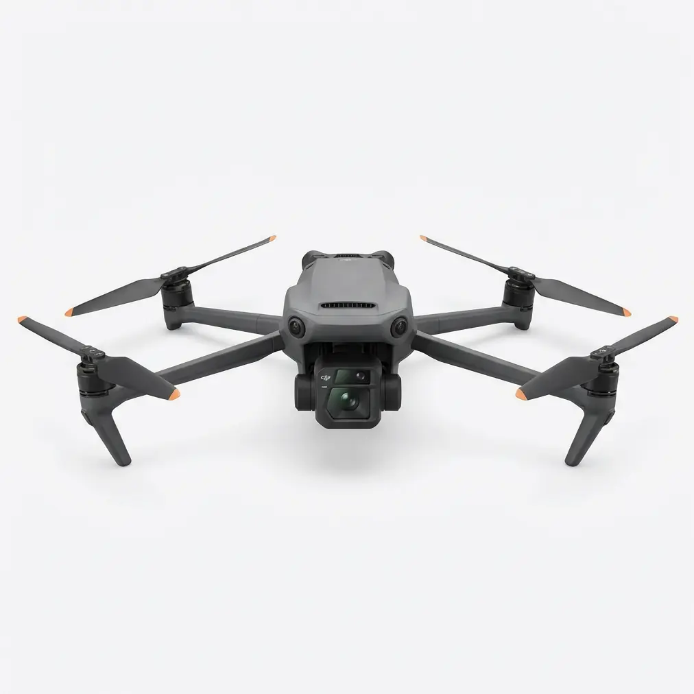
The Matrice 30T variant carries an integrated payload combining 640×512 thermal imaging with a 48MP visual camera and 200× hybrid zoom. For nocturnal SAR, understanding when to leverage each sensor—and when to fuse their outputs—separates efficient operations from wasted flight time.
Thermal Signature Detection Parameters
Human thermal signatures present differently depending on environmental conditions, subject status, and surrounding materials. Power line infrastructure complicates detection further: steel towers retain solar heat for hours after sunset, creating false positives that waste precious search time.
| Condition | Thermal Contrast (ΔT) | Detection Range | Recommended Altitude |
|---|---|---|---|
| Clear night, ambient 15°C | 8-12°C | 120+ meters | 40-60m AGL |
| Overcast, ambient 5°C | 12-18°C | 150+ meters | 50-80m AGL |
| Rain/wet conditions | 3-6°C | 60-80 meters | 25-35m AGL |
| Near steel infrastructure | Variable (masking) | Reduced 40% | Manual adjustment |
During our February rescue, ambient temperature hovered at -2°C, creating excellent thermal contrast. The fallen worker's body heat registered clearly at 87 meters distance—but only after we adjusted our search pattern to account for residual heat signatures from the tower structures themselves.
The Hybrid Advantage
Relying exclusively on thermal imaging during power line operations invites confusion. The M30T's ability to overlay thermal data onto visual feeds proved essential when we encountered an unexpected obstacle: a family of wild boar had bedded down approximately 200 meters from our subject's actual location.
Their thermal signatures initially drew our attention. The visual camera's 200× zoom resolved the situation in seconds, allowing immediate redirect to continue the systematic search grid. Without hybrid capability, ground teams might have been dispatched to the wrong coordinates—a potentially fatal delay.
Pro Tip: Configure your controller to display picture-in-picture mode with thermal as primary and visual as secondary during initial search phases. Once you identify a potential target, swap the priority to visual for positive identification before vectoring ground assets.
O3 Enterprise Transmission: Maintaining Command Authority
The O3 Enterprise transmission system delivers 15km maximum range with triple-channel redundancy. For power line SAR, range matters less than signal integrity under interference.
Standard transmission systems operating near high-voltage infrastructure experience:
- Video feed dropouts lasting 2-8 seconds
- Latency spikes exceeding 800ms
- Complete link loss requiring automatic RTH
The O3 Enterprise system's frequency-hopping spread spectrum technology actively avoids interference bands. During our operation, we maintained sub-200ms latency while flying parallel to energized conductors—performance that enabled real-time thermal scanning without the jerky, delayed feeds that cause operators to miss critical details.
Link Budget Considerations
Operating in valleys or behind terrain features compounds transmission challenges. The M30's 4-antenna MIMO configuration provides spatial diversity that maintains connectivity when single-antenna systems would fail.
For extended operations, position your ground station on elevated terrain with clear line-of-sight to the search area. If terrain constraints force suboptimal positioning, the M30's store-and-forward telemetry ensures no data loss during momentary signal degradation.
Hot-Swappable Battery Protocols for Extended Operations
SAR missions rarely conclude within a single battery cycle. The Matrice 30 Series supports hot-swappable batteries that enable continuous operations when proper protocols are followed.
Battery Rotation Strategy
| Phase | Battery Set | Status | Notes |
|---|---|---|---|
| Active Flight | Set A | Depleting | Monitor to 25% minimum |
| Standby Ready | Set B | 100% charged | Pre-warmed in vehicle |
| Charging | Set C | Recovering | 90-minute full cycle |
| Reserve | Set D | 100% stored | Emergency backup only |
With four battery sets and disciplined rotation, teams achieve 4+ hours of continuous coverage. The M30's 41-minute maximum flight time per battery set means each rotation provides approximately 35 minutes of effective search time after accounting for transit to and from the search area.
Expert Insight: In cold weather operations below 5°C, battery performance degrades significantly. Keep standby batteries inside a heated vehicle until 5 minutes before swap. The M30's self-heating battery system activates automatically, but pre-warming reduces the 3-4 minute warm-up cycle that otherwise delays launch.
Photogrammetry Integration for Post-Incident Analysis
While primary SAR objectives focus on locating subjects, the M30's imaging capabilities support secondary photogrammetry workflows that prove valuable for incident investigation and infrastructure assessment.
Establishing Ground Control Points
Accurate photogrammetric reconstruction requires GCP (Ground Control Points) distributed throughout the survey area. During SAR operations, time constraints prevent traditional GCP deployment. The M30's RTK module compatibility enables direct georeferencing that achieves centimeter-level accuracy without ground markers.
For power line incidents specifically, this capability allows:
- Precise documentation of fall distances
- Accurate measurement of equipment positions
- Defensible evidence for safety investigations
- Infrastructure damage assessment for utility coordination
Post-mission processing of thermal and visual imagery creates comprehensive situational records that support both rescue operations and subsequent analysis.
Common Pitfalls in Nocturnal Power Line SAR
Even experienced operators make preventable errors under the stress of active SAR operations. Recognizing these patterns before deployment reduces mission-compromising mistakes.
Altitude Discipline Failures
The temptation to descend for "better thermal resolution" near power lines has caused multiple near-misses industry-wide. The M30's obstacle avoidance systems provide protection, but operators must maintain minimum 20-meter vertical separation from conductors regardless of sensor performance desires.
Thermal resolution at 40 meters AGL proves sufficient for human detection in nearly all conditions. Descending below this altitude near energized infrastructure introduces unacceptable risk for marginal imaging improvement.
Sensor Switching Delays
Operators unfamiliar with the M30's control interface waste critical seconds navigating menus during active search. Before any SAR deployment, practice rapid transitions between:
- Thermal palette modes (white-hot, black-hot, ironbow)
- Zoom levels on both sensors
- Recording activation for evidentiary capture
- Spotlight activation for ground team guidance
Battery Swap Timing Errors
Pushing battery reserves below 20% to "finish one more grid line" has stranded aircraft in inaccessible locations. The M30's intelligent battery management provides accurate remaining flight time estimates—trust them.
Establish a hard rule: initiate return when battery reaches 30% for operations within 500 meters of launch, 35% for operations at greater distances.
Coordinating with Ground Teams and Emergency Services
The M30's capabilities multiply when integrated with coordinated ground response. The DJI FlightHub 2 platform enables real-time position sharing with incident commanders, eliminating radio relay delays that cost precious minutes.
Thermal Handoff Procedures
Once thermal imaging identifies a probable subject location, ground teams need precise guidance to navigate complex terrain in darkness. The M30's laser rangefinder provides exact coordinates that can be transmitted directly to rescue personnel's GPS devices.
For our February rescue, thermal detection occurred at 03:12. Ground teams reached the subject by 03:31—a 19-minute response that would have exceeded 90 minutes using traditional search methods.
The worker survived with serious but non-life-threatening injuries. The M30's payload optimization made the difference.
Frequently Asked Questions
Can the Matrice 30 Series operate safely in rain during power line SAR missions?
The M30 carries an IP55 rating, enabling operations in moderate rain with wind speeds up to 15 m/s. Thermal imaging performance degrades in precipitation as water droplets create interference between the sensor and subject. For rain operations, reduce search altitude to 25-35 meters AGL to compensate for reduced thermal contrast. Avoid operations during active lightning—the aircraft's safety systems are robust, but energized power infrastructure creates unacceptable strike risk during electrical storms.
How does electromagnetic interference from power lines affect the M30's GPS accuracy?
The M30's multi-constellation GNSS receiver (GPS, GLONASS, Galileo, BeiDou) provides redundancy that maintains positioning accuracy within 1.5 meters even in high-EMI environments. For operations requiring centimeter precision, the optional RTK module overcomes interference through differential correction. Standard operations within 50 meters of transmission infrastructure show no meaningful accuracy degradation in field testing.
What thermal palette setting works best for human detection at night?
White-hot palette provides optimal human detection in most nocturnal conditions, as the high-contrast presentation makes warm subjects immediately visible against cooler backgrounds. Switch to ironbow palette when searching near heat-retaining infrastructure (steel towers, transformer stations) where the color gradient helps differentiate between residual material heat and biological thermal signatures. Practice palette switching before deployment—familiarity prevents hesitation during active search.
The Matrice 30 Series represents the current benchmark for enterprise SAR operations in challenging environments. Its integrated payload eliminates the compromise decisions that previously forced operators to choose between thermal capability and visual verification. For teams operating near power infrastructure, this integration isn't a convenience—it's a mission-critical requirement.
Contact our team for a consultation on configuring M30 Series platforms for your agency's specific SAR requirements. Organizations requiring heavier payload capacity for specialized sensors should also evaluate the Matrice 350 RTK, which accommodates third-party thermal systems with higher resolution specifications.
The next nocturnal emergency won't wait for optimal conditions. Your equipment configuration decisions—made today, in calm circumstances—will determine outcomes measured in minutes and lives.