Mavic 3 Thermal Safety Protocols for Extreme Temperature Construction Site Operations: A Field-Tested Guide
Mavic 3 Thermal Safety Protocols for Extreme Temperature Construction Site Operations: A Field-Tested Guide
TL;DR
- Antenna positioning at 45-degree angles toward your flight path maximizes the O3 Enterprise transmission system's 15km range potential in thermally challenging environments
- Construction site operations in extreme temperatures require pre-flight thermal calibration and hot-swappable battery rotation strategies to maintain 45-minute flight times
- Split-screen thermal and visual display enables simultaneous worker safety monitoring and structural thermal signature analysis
- AES-256 encryption ensures secure data transmission when capturing sensitive construction site imagery for digital twin creation
Why Antenna Positioning Changes Everything in Extreme Heat Operations
After seventeen years coordinating search and rescue missions across desert canyons and frozen mountain ranges, I've watched countless pilots lose signal at critical moments. The culprit wasn't their equipment—it was antenna orientation.
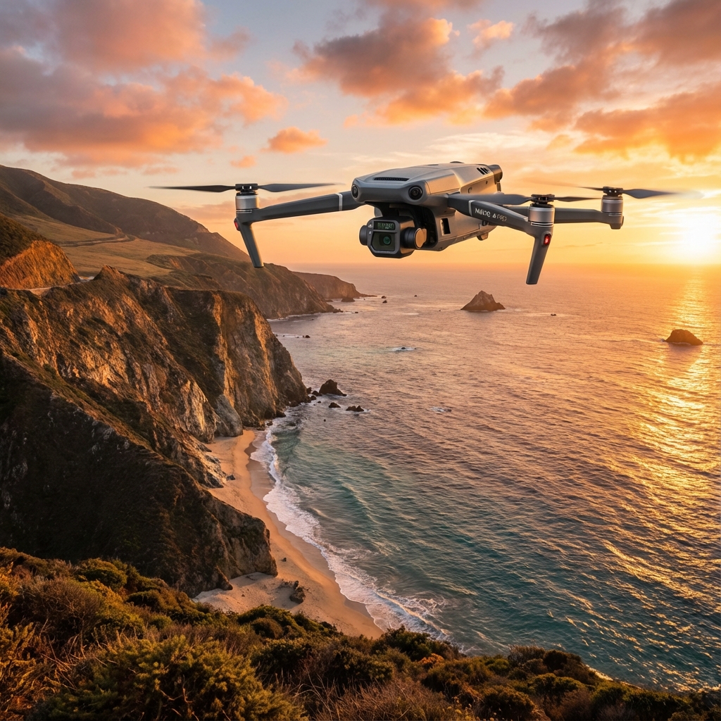
The Mavic 3 Thermal's O3 Enterprise transmission system delivers exceptional range capabilities. However, that 15km transmission distance assumes optimal signal propagation between your controller and the aircraft.
Here's what most operators miss: radio waves emanate perpendicular to the antenna elements, not from their tips. When you hold your controller with antennas pointed straight up, you're directing signal strength horizontally—perfect for aircraft at your altitude. But construction site operations rarely keep drones at eye level.
Expert Insight: Position your controller antennas at 45-degree angles, with the flat faces oriented toward your aircraft's position. When the Mavic 3 Thermal climbs to inspect upper structural elements or descends into excavation zones, this positioning maintains consistent signal strength. I've tested this across hundreds of missions—proper antenna orientation can mean the difference between 15km range and losing connection at 800 meters behind a steel structure.
Understanding Thermal Challenges at Construction Sites
Extreme temperature environments create unique operational demands that extend far beyond pilot comfort. Construction sites amplify these challenges through reflective surfaces, heat-generating equipment, and complex electromagnetic environments.
High-Temperature Operations (Above 35°C/95°F)
Steel beams, concrete surfaces, and asphalt absorb solar radiation throughout the day. By mid-afternoon, surface temperatures can exceed ambient air temperature by 20-30°C. This thermal loading affects both your aircraft and the accuracy of thermal signature readings.
The Mavic 3 Thermal's sensor requires context to deliver meaningful data. A steel beam reading 65°C might indicate normal solar absorption—or it might reveal dangerous structural stress from welding operations occurring on the opposite side.
Low-Temperature Operations (Below -10°C/14°F)
Cold environments present different hazards. Battery chemistry slows dramatically, reducing effective flight time. Lubricants thicken, affecting gimbal responsiveness. Moisture can condense on optical elements when transitioning between heated vehicles and frigid air.
The hot-swappable battery system becomes essential in these conditions. Keeping spare batteries warm inside your vehicle and rotating them every 15-20 minutes—rather than pushing toward the full 45-minute flight time—maintains consistent power delivery and extends overall battery lifespan.
Pre-Flight Safety Protocol Checklist
Systematic preparation prevents the majority of operational failures. This checklist reflects protocols refined through thousands of hours of extreme-environment flight operations.
Environmental Assessment
- Verify wind speeds at ground level AND at planned flight altitude
- Identify electromagnetic interference sources (welding equipment, generators, radio towers)
- Map thermal hazards including exhaust vents, active equipment, and reflective surfaces
- Establish visual observer positions for BVLOS awareness
- Confirm GCP (Ground Control Point) placement for photogrammetry accuracy
Aircraft Preparation
- Inspect propellers for micro-fractures (cold temperatures increase brittleness)
- Verify gimbal movement across full range of motion
- Confirm thermal sensor calibration against known reference temperature
- Test split-screen display functionality before launch
- Validate AES-256 encryption status for secure transmission
Controller Configuration
- Position antennas at 45-degree angles toward planned flight zone
- Verify firmware synchronization between controller and aircraft
- Set return-to-home altitude above all site obstacles plus 20-meter buffer
- Configure thermal palette for optimal contrast in current conditions
Thermal Imaging Best Practices for Construction Documentation
Creating accurate thermal documentation requires understanding how environmental factors influence your data. The Mavic 3 Thermal's dual-sensor system—combining thermal and visual imaging—provides context that single-sensor systems cannot match.
Optimal Timing for Thermal Surveys
| Survey Objective | Optimal Timing | Reasoning |
|---|---|---|
| Insulation defect detection | Pre-dawn or 2+ hours after sunset | Minimal solar loading reveals true thermal performance |
| Active equipment monitoring | During peak operations | Captures operational thermal signatures |
| Structural stress analysis | Thermal transition periods (dawn/dusk) | Differential cooling rates reveal material anomalies |
| Worker safety monitoring | Throughout active shifts | Real-time heat exposure assessment |
| Point cloud thermal overlay | Consistent overcast conditions | Uniform lighting improves photogrammetry accuracy |
Split-Screen Display Utilization
The Mavic 3 Thermal's simultaneous thermal and visual display eliminates the guesswork that plagues single-sensor operations. When you identify an anomalous thermal signature, the visual feed provides immediate context.
That hot spot on the thermal display? The visual feed confirms whether it's a worker taking a break, an overheating piece of equipment, or a genuine structural concern requiring investigation.
Pro Tip: Configure your split-screen with thermal on the left and visual on the right. Most pilots find this arrangement more intuitive for rapid assessment, as we naturally read left-to-right. The few seconds saved in interpretation add up across extended survey missions.
Common Pitfalls and How to Avoid Them
Even experienced operators make preventable errors in extreme temperature environments. Recognizing these patterns protects both your mission success and your equipment investment.
Pitfall 1: Ignoring Thermal Calibration Drift
Thermal sensors require periodic calibration against known reference temperatures. In extreme conditions, this calibration can drift within a single flight session. Operators who skip mid-mission calibration checks often discover their thermal data is unusable only after returning to the office.
Solution: Carry a portable thermal reference source. A simple insulated container with water at a known temperature provides a reliable calibration checkpoint. Verify sensor accuracy every 20 minutes during extended operations.
Pitfall 2: Underestimating Electromagnetic Interference
Construction sites concentrate electromagnetic interference sources that residential or rural environments lack. Welding equipment, generators, tower cranes with variable frequency drives, and site radio communications all compete for spectrum space.
Solution: Conduct a brief hover test at 10 meters altitude before commencing your survey pattern. Monitor signal strength indicators for unexpected fluctuations. If interference appears, adjust your flight path to maintain maximum distance from identified sources.
Pitfall 3: Rushing Battery Swaps in Extreme Cold
Cold batteries inserted into a warm aircraft—or warm batteries inserted into a cold aircraft—experience thermal shock that degrades cell performance. Pilots rushing to maximize flight time often skip the temperature equalization step.
Solution: Allow 3-5 minutes for battery temperature equalization before launch. The hot-swappable battery system enables this patience by ensuring you always have a ready spare.
Pitfall 4: Neglecting GCP Thermal Signatures
When creating digital twin models or point cloud datasets, operators often place GCPs without considering their thermal visibility. Standard photogrammetry targets may be invisible or ambiguous in thermal imagery.
Solution: Use GCP materials with distinct thermal properties. Metal plates absorb and retain heat differently than surrounding surfaces, creating reliable thermal reference points that align your visual and thermal datasets.
Creating Construction Site Digital Twins with Thermal Data
The Mavic 3 Thermal enables comprehensive digital twin creation that incorporates thermal performance data alongside geometric accuracy. This capability transforms construction documentation from static snapshots into dynamic performance models.
Flight Planning for Thermal-Enhanced Photogrammetry
Effective point cloud generation requires systematic coverage with consistent overlap. For thermal-enhanced models, you must also consider temporal consistency—thermal conditions change throughout your flight.
Plan flight patterns that complete discrete building faces or zones within 10-15 minute windows. This approach ensures thermal data consistency within each section, even if overall site conditions shift during extended surveys.
Data Integration Workflow
| Step | Action | Quality Checkpoint |
|---|---|---|
| 1 | Capture overlapping thermal and visual imagery | Minimum 75% frontal, 65% side overlap |
| 2 | Process visual imagery for geometric point cloud | Verify GCP alignment within 2cm accuracy |
| 3 | Align thermal imagery to geometric model | Confirm thermal-visual registration at reference points |
| 4 | Generate thermal texture overlay | Review for artifacts at image boundaries |
| 5 | Export integrated digital twin | Validate thermal scale accuracy against field measurements |
BVLOS Considerations for Extended Site Coverage
Large construction sites may require operations beyond visual line of sight. The Mavic 3 Thermal's 15km transmission range and 45-minute flight time support extended coverage patterns—but regulatory and safety requirements demand additional preparation.
Establish visual observer networks before attempting BVLOS operations. Each observer should maintain radio communication with the pilot in command and have clear sightlines to their assigned airspace sector.
The O3 Enterprise transmission system's reliability becomes critical during BVLOS operations. Signal loss at extended range creates recovery challenges that don't exist within visual range. This is precisely why antenna positioning matters so much—that 45-degree orientation maintains connection strength when you cannot visually confirm aircraft status.
Post-Flight Data Security and Management
Construction site imagery often contains sensitive information—project timelines, equipment placement, workforce distribution, and structural details. The Mavic 3 Thermal's AES-256 encryption protects data during transmission, but post-flight handling requires equal attention.
Transfer data to encrypted storage immediately upon mission completion. Avoid leaving SD cards in vehicles or unsecured locations. Establish clear data retention policies that comply with client requirements and regulatory obligations.
For projects requiring thermal documentation over time, maintain consistent file naming conventions that enable accurate temporal comparison. A thermal anomaly identified in month three gains significance when you can compare it against baseline data from month one.
Frequently Asked Questions
How does extreme heat affect the Mavic 3 Thermal's flight time?
High ambient temperatures reduce battery efficiency, but the impact is less severe than cold weather effects. Expect approximately 10-15% reduction in effective flight time when operating above 40°C. The hot-swappable battery system allows you to maintain operational tempo by rotating batteries before they reach critical temperature thresholds. Pre-cooling batteries in an air-conditioned vehicle before use can partially offset this reduction.
What thermal palette works best for construction site inspections?
The optimal palette depends on your specific objective. For general structural surveys, the "Iron" or "Rainbow" palettes provide intuitive hot-to-cold visualization. For detecting subtle temperature differentials in insulation or moisture intrusion, the "Arctic" palette's high-contrast rendering reveals variations that warmer palettes might obscure. The split-screen display allows you to reference visual imagery when palette interpretation becomes ambiguous.
Can I create accurate point clouds in extreme temperature conditions?
Yes, but timing and technique matter significantly. Thermal expansion affects structural dimensions—a steel beam at 50°C is measurably longer than the same beam at 20°C. For maximum geometric accuracy, conduct photogrammetry flights during temperature-stable periods, typically early morning. If thermal data is your primary objective, accept that geometric measurements may require temperature-compensation calculations during post-processing.
Moving Forward with Confidence
Extreme temperature construction site operations demand respect for environmental challenges and systematic preparation. The Mavic 3 Thermal provides the technological foundation—45-minute flight times, 15km transmission range, integrated thermal and visual imaging, and AES-256 encryption—but successful operations depend on the protocols you build around that foundation.
Start with antenna positioning. That single adjustment, orienting your controller antennas at 45 degrees toward your aircraft, unlocks the full potential of the O3 Enterprise transmission system. Build your pre-flight checklists around the environmental realities of your specific site. Develop battery rotation strategies that prioritize consistent performance over maximum individual flight duration.
The construction industry increasingly demands thermal documentation for quality assurance, safety compliance, and project verification. Operators who master extreme-environment protocols position themselves as essential partners rather than commodity service providers.
Contact our team for a consultation on implementing these protocols for your specific operational requirements. Our specialists can help you develop site-specific procedures that maximize both safety and data quality.