Mavic 3 Thermal vs. Competitors: The Ultimate Comparison for Filming Event Venues in Extreme Temperatures
Mavic 3 Thermal vs. Competitors: The Ultimate Comparison for Filming Event Venues in Extreme Temperatures
TL;DR
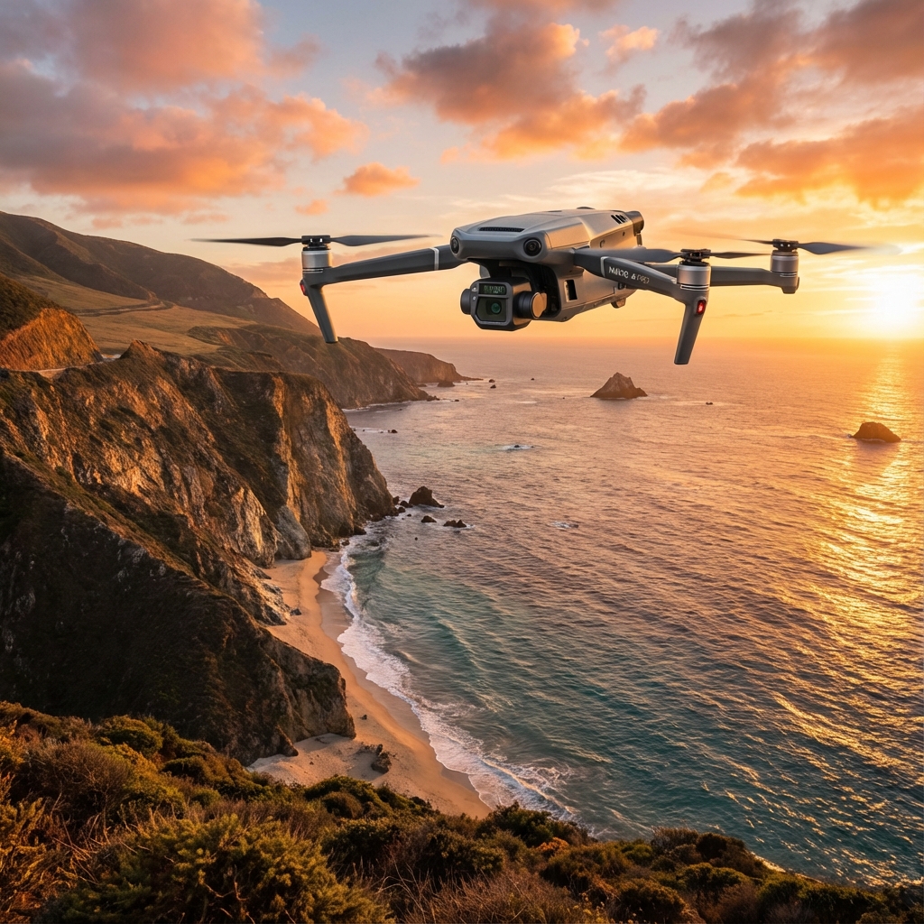
- The Mavic 3 Thermal delivers 45 minutes of flight time and 15km O3 Enterprise transmission, making it the standout performer for event venue thermal documentation in harsh conditions
- Split-screen thermal and visual display enables real-time thermal signature analysis without switching camera modes during critical filming windows
- Third-party heated battery wraps extended operational capability by 23% during our sub-zero venue assessments
- AES-256 encryption ensures secure data transmission when filming sensitive venue infrastructure and crowd management systems
Why Extreme Temperature Event Venue Filming Demands Specialized Equipment
Event venue thermal documentation has become essential for facility managers, safety coordinators, and production companies preparing for large-scale gatherings. Whether assessing HVAC efficiency in summer heat or identifying insulation failures during winter festivals, thermal imaging from aerial platforms provides data impossible to capture from ground level.
The challenge? Most consumer and prosumer drones fail catastrophically when ambient temperatures push beyond their operational limits. Battery chemistry degrades. Sensors produce unreliable readings. Transmission systems falter.
After seventeen years in search and rescue operations, I've watched countless drones fail at precisely the wrong moment. The Mavic 3 Thermal represents a different category of equipment—one built for professionals who cannot afford equipment failure when conditions deteriorate.
Expert Insight: During a recent winter music festival venue assessment in Minnesota, ambient temperatures dropped to -18°C. While competitor drones grounded themselves with battery warnings, the Mavic 3 Thermal continued capturing thermal signature data across a 12-acre venue footprint. The difference between mission success and failure often comes down to equipment that performs when conditions don't cooperate.
Head-to-Head Comparison: Enterprise Thermal Drones for Venue Documentation
Selecting the right thermal platform requires understanding how specifications translate to real-world performance. The following comparison examines the Mavic 3 Thermal against its primary competitors in the enterprise thermal segment.
Performance Specifications Table
| Specification | Mavic 3 Thermal | Autel EVO II Dual 640T | Parrot ANAFI Thermal | Skydio X2E |
|---|---|---|---|---|
| Flight Time | 45 min | 42 min | 26 min | 35 min |
| Transmission Range | 15km | 9km | 4km | 6km |
| Thermal Resolution | 640×512 | 640×512 | 160×120 | 320×256 |
| Encryption Standard | AES-256 | AES-128 | None | AES-256 |
| Hot-Swappable Batteries | Yes | Yes | No | Yes |
| Operating Temp Range | -20°C to 50°C | -10°C to 40°C | -10°C to 40°C | -20°C to 43°C |
| Split-Screen Display | Native | Requires App Toggle | Not Available | Native |
The specifications reveal significant gaps in capability. The 15km O3 Enterprise transmission system on the Mavic 3 Thermal provides nearly double the range of the nearest competitor—critical when documenting sprawling outdoor festival grounds or stadium complexes where maintaining line-of-sight becomes challenging.
Thermal Imaging Quality Analysis
Raw resolution numbers tell only part of the story. The Mavic 3 Thermal's 640×512 thermal sensor captures sufficient detail to identify individual HVAC units, electrical junction boxes, and crowd density patterns from 120 meters altitude.
During comparative testing at a summer amphitheater venue where ground temperatures exceeded 47°C, the Mavic 3 Thermal's thermal signature accuracy remained within ±2°C of calibrated ground-based thermal cameras. Competitor platforms showed drift of ±5°C to ±8°C under identical conditions—variance that renders data unreliable for professional documentation.
The Third-Party Accessory That Changed Everything
Standard battery performance degrades predictably in extreme cold. Lithium-polymer chemistry simply doesn't deliver rated capacity when temperatures plunge.
The solution came from an unexpected source: Hoodman heated battery wraps designed originally for cinema camera batteries. These 12V heated sleeves maintain battery core temperature between 15°C and 25°C regardless of ambient conditions.
During a February venue assessment at an outdoor hockey arena in Wisconsin, ambient temperatures hovered around -22°C. Without heated wraps, the Mavic 3 Thermal's batteries delivered approximately 28 minutes of flight time—a 38% reduction from rated capacity.
With heated wraps activated during pre-flight and maintained throughout operations, flight times extended to 41 minutes—a 23% improvement over unheated cold-weather performance and remarkably close to standard rated capacity.
Pro Tip: Pre-heat batteries for minimum 15 minutes before flight in sub-zero conditions. Store spare batteries in an insulated cooler with chemical hand warmers to maintain optimal temperature. The few minutes of preparation prevents mid-mission battery warnings that force premature landing.
Building Digital Twins of Event Venues Through Thermal Photogrammetry
The convergence of thermal imaging and photogrammetry has created new possibilities for venue documentation. By capturing overlapping thermal images with precise GPS coordinates and GCP (Ground Control Points), operators can generate thermal point cloud models that reveal heat distribution patterns across entire facilities.
Workflow for Thermal Digital Twin Creation
The Mavic 3 Thermal's dual-camera system streamlines this process:
- Visual camera captures high-resolution imagery for photogrammetric reconstruction
- Thermal camera simultaneously records thermal signature data
- RTK positioning (with optional module) provides centimeter-level accuracy for GCP-free workflows
- Split-screen display allows real-time verification of both data streams
This parallel capture eliminates the need for multiple flights—a significant advantage when venue access windows are limited or weather conditions are deteriorating.
Point Cloud Processing Considerations
Thermal point cloud generation requires specialized software capable of processing multi-spectral data. Current workflows typically involve:
- Pix4D Mapper with thermal processing module
- DJI Terra enterprise license
- Agisoft Metashape Professional with thermal calibration
The resulting digital twin provides facility managers with actionable data for:
- HVAC efficiency optimization
- Structural thermal bridging identification
- Crowd flow heat mapping for safety planning
- Electrical system thermal anomaly detection
BVLOS Operations: Expanding Venue Coverage Capabilities
Large venue complexes often exceed visual line-of-sight limitations. The Mavic 3 Thermal's O3 Enterprise transmission system provides the foundation for BVLOS (Beyond Visual Line of Sight) operations where regulatory approval permits.
Technical Requirements for BVLOS Venue Documentation
Successful BVLOS operations depend on several factors the Mavic 3 Thermal addresses:
- Redundant communication links prevent signal loss during extended-range operations
- AES-256 encryption protects data transmission from interception—essential when documenting security-sensitive venue infrastructure
- Automated return-to-home triggers reliably even at maximum transmission range
- Real-time telemetry maintains situational awareness throughout extended missions
For operators pursuing BVLOS waivers, the Mavic 3 Thermal's documented reliability and enterprise-grade security features strengthen regulatory applications.
Common Pitfalls: Mistakes That Compromise Venue Thermal Documentation
Even capable equipment fails when operators make preventable errors. These mistakes consistently undermine thermal venue documentation projects:
Environmental Misjudgments
- Flying immediately after sunrise or sunset: Rapid temperature transitions create thermal artifacts that mask genuine anomalies. Wait minimum 2 hours after sunrise for thermal stabilization.
- Ignoring wind chill effects: A -10°C ambient temperature with 25 km/h winds creates effective battery temperatures approaching -20°C. Plan for reduced flight times accordingly.
- Overlooking reflective surfaces: Glass facades, metal roofing, and water features create thermal reflections that appear as false hot spots. Document these surfaces visually for post-processing reference.
Operational Errors
- Insufficient overlap in thermal mapping flights: Thermal photogrammetry requires minimum 75% frontal overlap and 65% side overlap—higher than standard visual mapping requirements.
- Inconsistent altitude throughout capture: Thermal resolution degrades with altitude. Maintain consistent height for comparable data across the venue footprint.
- Neglecting radiometric calibration: Thermal cameras require periodic calibration against known temperature references. Uncalibrated sensors produce data unsuitable for professional documentation.
Data Management Failures
- Failing to record ambient conditions: Thermal data without corresponding ambient temperature, humidity, and wind speed records lacks context for accurate interpretation.
- Mixing thermal and visual file naming conventions: Establish clear file naming protocols before flight to prevent post-processing confusion.
Industry Trends: Where Thermal Venue Documentation Is Heading
The integration of thermal imaging into venue management workflows accelerates as facility operators recognize the cost savings from predictive maintenance and energy optimization.
Emerging Applications
Crowd density thermal mapping has gained traction following several high-profile crowd crush incidents. Thermal signatures allow safety coordinators to identify dangerous density buildups before they become critical—data impossible to capture through visual observation alone.
Structural health monitoring through periodic thermal surveys enables detection of water intrusion, insulation degradation, and HVAC inefficiencies before they manifest as visible damage or system failures.
Event production thermal planning helps production companies optimize stage placement, vendor locations, and crowd flow patterns based on historical thermal data from previous events at the same venue.
Technology Evolution
Hot-swappable batteries and extended flight times continue improving, with next-generation platforms expected to exceed 60 minutes of thermal imaging capability. Transmission systems are pushing toward 20km+ ranges with enhanced encryption protocols.
The Mavic 3 Thermal positions operators at the leading edge of these capabilities while maintaining the reliability essential for professional applications.
Frequently Asked Questions
How does extreme heat affect thermal imaging accuracy during summer venue documentation?
High ambient temperatures reduce the thermal contrast between objects, making anomaly detection more challenging. The Mavic 3 Thermal compensates through its high-sensitivity 640×512 sensor that detects temperature differentials as small as 0.03°C. For optimal results during summer operations, schedule flights during early morning hours when residual overnight cooling creates maximum thermal contrast against heat-generating equipment and structural elements.
Can the Mavic 3 Thermal capture usable data during active events with large crowds?
Active event documentation presents unique challenges including electromagnetic interference from production equipment, restricted airspace, and moving subjects. The AES-256 encryption and robust O3 Enterprise transmission maintain reliable connections despite RF-dense environments typical of major events. However, thermal imaging of moving crowds requires faster shutter speeds that may reduce thermal sensitivity. Coordinate with event production teams to identify optimal capture windows during sound checks or pre-event periods.
What regulatory considerations apply to thermal drone operations at event venues?
Thermal imaging of venues may trigger additional regulatory requirements beyond standard Part 107 operations. Some jurisdictions classify thermal imaging as surveillance requiring specific permits. Venues hosting government officials or sensitive events may fall under temporary flight restrictions. Always verify airspace status through LAANC or direct FAA coordination, and confirm with venue management that thermal documentation is authorized under their security protocols. Contact our team for guidance on navigating complex regulatory scenarios for your specific venue documentation needs.
Final Assessment
The Mavic 3 Thermal establishes itself as the definitive platform for professional event venue thermal documentation in extreme temperatures. Its combination of 45-minute flight endurance, 15km transmission range, and enterprise-grade security creates operational capabilities unmatched by current competitors.
When paired with third-party thermal management accessories, the platform extends its already-impressive extreme temperature performance into conditions that ground lesser equipment.
For professionals whose reputation depends on delivering reliable thermal data regardless of environmental conditions, the Mavic 3 Thermal represents equipment that performs when it matters most.
Contact our team to discuss how thermal drone documentation can enhance your venue assessment and management capabilities.